|
search place name
|
||
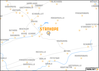
Stanhope (Pennsylvania, United States - USA)Stanhope is a town in the Pennsylvania region of United States - USA. An overview map of the region around Stanhope is displayed below.
regional and 3d topo map of Stanhope, United States - USA ::
Stanhope airports ::
The nearest airport is MUI - Muir Aaf, located 21.5 km south west of Stanhope.
Other airports nearby include MDT - Harrisburg Intl (51.5 km south west), IPT - Williamsport Rgnl (92.0 km north west), NXX - Willow Grove Nas Jrb (108.8 km east), ILG - Wilmington New Castle (114.3 km south east), Nearby towns ::
Marstown (2.3km west) //
Pleasant Valley (3.5km north west) //
Brookside (2.9km west) //
Pine Grove (3.2km north west) //
Paradise (4.5km north west) //
De Turksville (5.0km north) //
Round Head (4.6km south east) //
Roedersville (6.2km north) //
Exmoor (5.1km west) //
Ravine (6.2km north west) //
Meckville (7.5km south) //
Echo Valley (8.0km north west) //
Lorberry Junction (7.9km north west) //
Bethel (8.4km south east) //
Rausch Creek (10.6km north west) //
[all distances 'as the bird flies' and approximate]  Places with similar names to Stanhope, United States - USA ::
Disclaimer :: Information on this page comes without warranty of any kind |
||
|
Where is Stanhope? Elevation and coordinates ::
Latitude (lat): 40°32'5"N Longitude (lon): 76°21'8"W
Elevation (approx.): 183m (map arrows pan, magnifying glasses zoom) |
||
|
Visiting Stanhope? Hotel/Accommodation ::
Book a hotel in Stanhope Travel Guide ::
rental cars ::
car rental offers GPS waypoint ::
download a GPX waypoint (PoI) of Stanhope for your GPS receiver
|
||