|
search place name
|
||
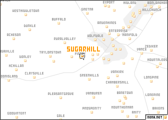
Sugar Hill (Pennsylvania, United States - USA)Sugar Hill is a town in the Pennsylvania region of United States - USA. An overview map of the region around Sugar Hill is displayed below.
regional and 3d topo map of Sugar Hill, United States - USA ::
Sugar Hill airports ::
The nearest airport is PIT - Pittsburgh (pennsylva) Pittsburgh Intl, located 38.2 km north of Sugar Hill.
Other airports nearby include YNG - Youngstown Warren Rgnl (127.0 km north), AKR - Akron Fulton Intl (138.7 km north west), EKN - Elkins Randolph Co Jennings Randolph (145.5 km south), AOO - Altoona Blair Co (170.1 km east), Nearby towns ::
Finney (0.8km north west) //
Lincoln Hill (1.5km east) //
Log Pile (1.9km north east) //
Coffeys Crossing (2.2km west) //
Elwood Park (2.7km north east) //
Franklin Farms (3.4km east) //
Green Hills (4.4km south) //
Wolfdale (4.9km north east) //
Gabby Heights (4.2km east) //
Rural Valley (5.1km north west) //
Oak Grove (5.7km north east) //
Bellevue (5.0km east) //
Point Lookout (5.7km south east) //
Taylorstown Station (5.2km west) //
Tylerdale (5.9km north east) //
Washington (5.9km north east) //
Taylorstown (5.8km west) //
Patton (6.7km north east) //
Arden (7.3km north east) //
Vankirk (6.7km south east) //
East Washington (6.6km east) //
Van Buren (8.5km south) //
Arden Mines (8.3km north east) //
Chambers Mill (8.2km south east) //
Enterprise (8.1km north east) //
Pleasant Grove (9.3km south west) //
Buffalo (9.3km north west) //
Rich Hill (9.8km north east) //
[all distances 'as the bird flies' and approximate]  Places with similar names to Sugar Hill, United States - USA ::
// Sugar Hill (US)
// Sugar Hill (US)
// Sugar Hill (US)
// Square Hill (ZA)
// Sugar Hill (US)
// Sugar Hill (US)
// Sugar Hill (US)
// Sugar Hill (US)
// Sugar Hill (US)
// Sugar Hill (US)
Disclaimer :: Information on this page comes without warranty of any kind |
||
|
Where is Sugar Hill? Elevation and coordinates ::
Latitude (lat): 40°9'8"N Longitude (lon): 80°18'37"W
Elevation (approx.): 426m (map arrows pan, magnifying glasses zoom) |
||
|
Visiting Sugar Hill? Hotel/Accommodation ::
Book a hotel in Sugar Hill Travel Guide ::
rental cars ::
car rental offers GPS waypoint ::
download a GPX waypoint (PoI) of Sugar Hill for your GPS receiver
|
||