|
search place name
|
||
Superior (Pennsylvania, United States - USA)Superior is a town in the Pennsylvania region of United States - USA. An overview map of the region around Superior is displayed below.
regional and 3d topo map of Superior, United States - USA ::

Superior airports ::
The nearest airport is PIT - Pittsburgh (pennsylva) Pittsburgh Intl, located 77.4 km west of Superior.
Other airports nearby include AOO - Altoona Blair Co (86.8 km east), YNG - Youngstown Warren Rgnl (151.4 km north west), EKN - Elkins Randolph Co Jennings Randolph (168.7 km south), IAD - Washington Dulles Intl (225.0 km south east), Nearby towns ::
Atlantic (1.6km east) //
New Derry (1.9km east) //
Peanut (2.9km south east) //
Bradenville (3.8km south) //
Snydertown (4.0km south) //
Burds Crossing (3.7km south east) //
Pandora (3.9km south west) //
Loyalhanna (4.2km south west) //
West Derry (4.2km south east) //
Derry (4.0km south east) //
Mechesneytown (4.8km south) //
Seger (4.6km east) //
Latrobe (5.2km south west) //
Cooperstown (6.0km south west) //
Millwood (5.1km east) //
Kingston (7.0km south) //
Osburn (6.9km south) //
Edgewater Terrace (7.8km south) //
Dorothy (7.5km south west) //
Lloydsville (7.3km south west) //
Hillside (6.7km east) //
Youngstown (8.7km south) //
Lawson Heights (8.3km south west) //
Brenizer (7.8km north east) //
Saint Vincent Shaft (9.5km south west) //
Burrell (9.2km north east) //
Bairdstown (9.9km north east) //
Blairsville (10.7km north east) //
[all distances 'as the bird flies' and approximate] 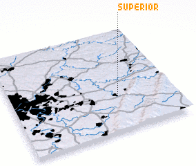 Places with similar names to Superior, United States - USA ::
Disclaimer :: Information on this page comes without warranty of any kind |
||
|
Where is Superior? Elevation and coordinates ::
Latitude (lat): 40°21'19"N Longitude (lon): 79°20'18"W
Elevation (approx.): 323m (map arrows pan, magnifying glasses zoom) |
||
|
Visiting Superior? Hotel/Accommodation ::
Book a hotel in Superior Travel Guide ::
rental cars ::
car rental offers GPS waypoint ::
download a GPX waypoint (PoI) of Superior for your GPS receiver
|
||