|
search place name
|
||
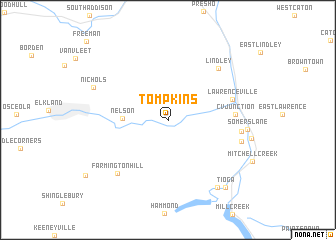
Tompkins (Pennsylvania, United States - USA)Tompkins is a town in the Pennsylvania region of United States - USA. An overview map of the region around Tompkins is displayed below.
regional and 3d topo map of Tompkins, United States - USA ::
Tompkins airports ::
The nearest airport is IPT - Williamsport Rgnl, located 84.7 km south of Tompkins.
Other airports nearby include ROC - Greater Rochester Intl (132.9 km north), SYR - Syracuse Hancock Intl (154.3 km north east), BUF - Buffalo Niagara Intl (165.9 km north west), MUI - Muir Aaf (179.0 km south), Nearby towns ::
Nelson (3.7km west) //
C V Junction (5.6km east) //
Lawrenceville (5.8km north east) //
Lindley (7.1km north east) //
Farmington Hill (7.3km south west) //
Rising (6.2km east) //
Beeman (6.6km east) //
Nichols (7.1km north west) //
Brooklyn (8.5km south east) //
Tioga (9.0km south east) //
[all distances 'as the bird flies' and approximate] 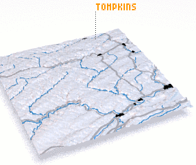 Places with similar names to Tompkins, United States - USA ::
Disclaimer :: Information on this page comes without warranty of any kind |
||
|
Where is Tompkins? Elevation and coordinates ::
Latitude (lat): 41°58'36"N Longitude (lon): 77°11'28"W
Elevation (approx.): 333m (map arrows pan, magnifying glasses zoom) |
||
|
Visiting Tompkins? Hotel/Accommodation ::
Book a hotel in Tompkins Travel Guide ::
rental cars ::
car rental offers GPS waypoint ::
download a GPX waypoint (PoI) of Tompkins for your GPS receiver
|
||