|
search place name
|
||
Trythall (Pennsylvania, United States - USA)Trythall is a town in the Pennsylvania region of United States - USA. An overview map of the region around Trythall is displayed below.
regional and 3d topo map of Trythall, United States - USA ::

Trythall airports ::
The nearest airport is NXX - Willow Grove Nas Jrb, located 51.5 km east of Trythall.
Other airports nearby include PHL - Philadelphia Intl (55.5 km south east), ILG - Wilmington New Castle (57.0 km south), MUI - Muir Aaf (75.0 km north west), TTN - Trenton Mercer (80.6 km east), Nearby towns ::
Saint Peters (1.8km east) //
Knauertown (2.4km south east) //
Harmonyville (2.7km east) //
Pine Swamp (2.9km west) //
Warwick (3.2km south west) //
Nantmeal Village (5.9km south east) //
East Nantmeal (6.7km south) //
Coventryville (5.4km east) //
Unionville (8.0km north east) //
Kulptown (8.1km north west) //
Loag (7.7km south west) //
Douglassville (8.9km north) //
Monocacy (9.1km north) //
Ludwigs Corner (8.7km south east) //
Bramcote (8.7km north east) //
Barneston (9.7km south west) //
West Pottsgrove (10.1km north east) //
Stowe (10.3km north east) //
[all distances 'as the bird flies' and approximate] 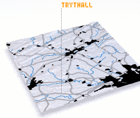 Places with similar names to Trythall, United States - USA ::
// Dauerthal (DE)
// Trout Hall (JM)
Disclaimer :: Information on this page comes without warranty of any kind |
||
|
Where is Trythall? Elevation and coordinates ::
Latitude (lat): 40°10'48"N Longitude (lon): 75°45'9"W
Elevation (approx.): 182m (map arrows pan, magnifying glasses zoom) |
||
|
Visiting Trythall? Hotel/Accommodation ::
Book a hotel in Trythall Travel Guide ::
rental cars ::
car rental offers GPS waypoint ::
download a GPX waypoint (PoI) of Trythall for your GPS receiver
|
||