|
search place name
|
||
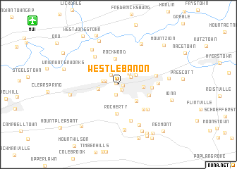
West Lebanon (Pennsylvania, United States - USA)West Lebanon is a town in the Pennsylvania region of United States - USA. An overview map of the region around West Lebanon is displayed below.
regional and 3d topo map of West Lebanon, United States - USA ::
West Lebanon airports ::
The nearest airport is MUI - Muir Aaf, located 14.5 km north west of West Lebanon.
Other airports nearby include MDT - Harrisburg Intl (31.7 km south west), APG - Aberdeen Phillips Aaf (100.3 km south), ILG - Wilmington New Castle (103.0 km south east), IPT - Williamsport Rgnl (107.4 km north), Nearby towns ::
Coheva (0.4km north west) //
Cornwall Junction (0.6km east) //
Pleasant Hill (1.0km south east) //
Woodfort (1.6km south) //
Ebenezer (1.8km north west) //
Pansy Hill (1.7km west) //
Lebanon Independent (1.9km north east) //
Sand Hill (2.1km north east) //
Westmont (2.0km west) //
Reinoeldville (2.6km north east) //
Cleona (2.6km west) //
Hauckville (3.4km south east) //
Lebanon (3.0km east) //
Sunset (3.4km north east) //
Rockwood (4.1km north) //
Heilmandale (3.8km north west) //
Rocherty (4.6km south) //
South Lebanon (4.1km south east) //
Hebron (4.0km east) //
Midway (5.0km south east) //
Mount Ararat (5.2km north west) //
Zinns Mill (5.9km south) //
Weavertown (4.8km east) //
Edisonville (5.4km south east) //
Avon (4.8km east) //
Bunker Hill (6.4km north west) //
Quentin (7.2km south) //
North Cornwall (6.9km south) //
Freeport Mills (7.0km north east) //
[all distances 'as the bird flies' and approximate]  Places with similar names to West Lebanon, United States - USA ::
// West Lebanon (US)
// West Lebanon (US)
// West Lebanon (US)
// West Lebanon (US)
// West Lebanon (US)
// West Lebanon (US)
// West Lebanon (US)
Disclaimer :: Information on this page comes without warranty of any kind |
||
|
Where is West Lebanon? Elevation and coordinates ::
Latitude (lat): 40°20'38"N Longitude (lon): 76°26'49"W
Elevation (approx.): 146m (map arrows pan, magnifying glasses zoom) |
||
|
Visiting West Lebanon? Hotel/Accommodation ::
Book a hotel in West Lebanon Travel Guide ::
rental cars ::
car rental offers GPS waypoint ::
download a GPX waypoint (PoI) of West Lebanon for your GPS receiver
|
||