|
search place name
|
||
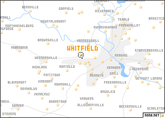
Whitfield (Pennsylvania, United States - USA)Whitfield is a town in the Pennsylvania region of United States - USA. An overview map of the region around Whitfield is displayed below.
regional and 3d topo map of Whitfield, United States - USA ::
Whitfield airports ::
The nearest airport is MUI - Muir Aaf, located 49.1 km west of Whitfield.
Other airports nearby include MDT - Harrisburg Intl (66.3 km west), NXX - Willow Grove Nas Jrb (74.5 km east), ILG - Wilmington New Castle (80.6 km south east), PHL - Philadelphia Intl (83.1 km south east), Nearby towns ::
Sinking Spring (1.0km south west) //
Springmont (1.2km south east) //
West Lawn (1.2km south east) //
Cacoosing (1.6km north) //
West Wyomissing (1.8km south east) //
Spring Ridge (2.3km north east) //
Wyomissing Hills (2.2km east) //
Lincoln Park (2.9km south east) //
Van Reeds Mill (3.5km north) //
Montrose (3.6km south east) //
State Hill (3.6km north west) //
Montello (3.7km south west) //
Wyomissing (3.5km east) //
Shillington (4.6km south east) //
Pennwyn (5.3km south east) //
Mohnton (5.9km south) //
Colonial Hills (6.1km south) //
Leinbachs (6.4km north) //
West Reading (5.0km east) //
Gouglersville (7.0km south) //
Kenhorst (6.3km south east) //
Mohns Hill (7.5km south west) //
River View Park (7.5km north east) //
Fritztown (7.0km south west) //
Wernersville (6.3km west) //
Grill (6.9km south east) //
Brownsville (6.9km north west) //
Reading (6.7km east) //
Muhlenberg (7.7km north east) //
[all distances 'as the bird flies' and approximate]  Places with similar names to Whitfield, United States - USA ::
Disclaimer :: Information on this page comes without warranty of any kind |
||
|
Where is Whitfield? Elevation and coordinates ::
Latitude (lat): 40°20'9"N Longitude (lon): 76°0'23"W
Elevation (approx.): 105m (map arrows pan, magnifying glasses zoom) |
||
|
Visiting Whitfield? Hotel/Accommodation ::
Book a hotel in Whitfield Travel Guide ::
rental cars ::
car rental offers GPS waypoint ::
download a GPX waypoint (PoI) of Whitfield for your GPS receiver
|
||