|
search place name
|
||
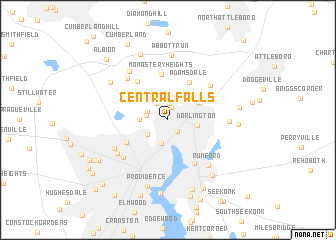
Central Falls (Rhode Island, United States - USA)Central Falls is a town in the Rhode Island region of United States - USA. An overview map of the region around Central Falls is displayed below.
regional and 3d topo map of Central Falls, United States - USA ::
nearby GPS traces from timatio ::
Central Falls airports ::
The nearest airport is PVD - Providence Theodore Francis Green State, located 17.7 km south of Central Falls.
Other airports nearby include BOS - Boston General Edward Lawrence Logan Intl (61.6 km north east), BED - Bedford Laurence G Hanscom Fld (64.9 km north), CEF - Chicopee Falls Westover Arb Metropolitan (100.4 km west), HFD - Hartford Brainard (105.8 km west), Nearby towns ::
Happy Hollow (1.5km north) //
Pawtucket (1.6km south east) //
Valley Falls (1.8km north) //
Lonsdale (2.1km north west) //
Saylesville (1.9km north west) //
Sayles Bleachery (1.9km west) //
Woodlawn (2.7km south) //
Fairlawn (2.3km south west) //
Saylesville Highlands (2.4km west) //
Darlington (2.5km east) //
South Attleboro (3.2km north east) //
Adamsdale (4.5km north east) //
Monastery Heights (5.1km north) //
Marieville (4.2km south west) //
Berkeley (5.0km north west) //
Phillipsdale (5.3km south east) //
Attleborough City (5.2km north east) //
Wanskuck (5.5km south west) //
Quinnville (5.8km north west) //
Geneva (5.6km south west) //
Rumford (6.0km south east) //
Woodville (5.4km south west) //
Ashton (6.2km north west) //
North Seekonk (5.2km east) //
Abbott Run (7.2km north) //
Lime Rock (6.4km north west) //
Providence (7.6km south) //
Perrins Crossing (5.9km east) //
Lippitt Estate (7.6km north) //
[all distances 'as the bird flies' and approximate]  Places with similar names to Central Falls, United States - USA ::
// Central Falls (US)
Disclaimer :: Information on this page comes without warranty of any kind |
||
|
Where is Central Falls? Elevation and coordinates ::
Latitude (lat): 41°53'26"N Longitude (lon): 71°23'34"W
Elevation (approx.): 29m (map arrows pan, magnifying glasses zoom) |
||
|
Visiting Central Falls? Hotel/Accommodation ::
Book a hotel in Central Falls Travel Guide ::
rental cars ::
car rental offers GPS waypoint ::
download a GPX waypoint (PoI) of Central Falls for your GPS receiver
|
||