|
search place name
|
||
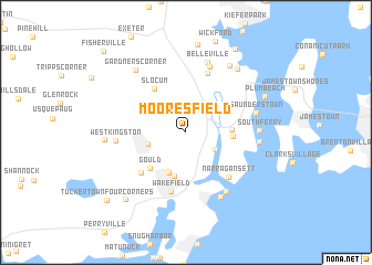
Mooresfield (Rhode Island, United States - USA)Mooresfield is a town in the Rhode Island region of United States - USA. An overview map of the region around Mooresfield is displayed below.
regional and 3d topo map of Mooresfield, United States - USA ::
Mooresfield airports ::
The nearest airport is PVD - Providence Theodore Francis Green State, located 27.5 km north of Mooresfield.
Other airports nearby include HFD - Hartford Brainard (100.6 km west), BOS - Boston General Edward Lawrence Logan Intl (105.0 km north), BED - Bedford Laurence G Hanscom Fld (110.0 km north), BDL - Windsor Locks Bradley Intl (111.2 km north west), Nearby towns ::
Indian Lake Shores (2.9km south east) //
Kingston (3.1km west) //
Rocky Brook (4.3km south) //
Peace Dale (4.5km south) //
Pettaquamscutt Lake Shores (3.5km east) //
Bridgetown (3.6km east) //
Gould (4.5km south west) //
Slocum (5.0km north west) //
Curtis Corner (5.3km south west) //
Wakefield (6.0km south) //
Narragansett (5.5km south east) //
Allenton (6.2km north) //
North Kingstown (6.9km north) //
West Kingston (5.4km west) //
Narragansett Beach (6.7km south east) //
Saunderstown (5.6km east) //
Belleville (7.2km north) //
Narragansett Pier (7.0km south) //
South Ferry (5.6km east) //
Bonnet Shores (5.6km east) //
Annaquatucket (7.5km north east) //
Gardners Corner (7.4km north west) //
Hamilton (7.5km north east) //
Kingston Station (6.2km west) //
Plum Beach (7.0km north east) //
Lafayette (8.9km north) //
Tuckertown (8.1km south west) //
Cold Spring Beach (9.2km north east) //
Tuckertown Four Corners (9.1km south west) //
[all distances 'as the bird flies' and approximate]  Places with similar names to Mooresfield, United States - USA ::
Disclaimer :: Information on this page comes without warranty of any kind |
||
|
Where is Mooresfield? Elevation and coordinates ::
Latitude (lat): 41°29'26"N Longitude (lon): 71°29'18"W
Elevation (approx.): 30m (map arrows pan, magnifying glasses zoom) |
||
|
Visiting Mooresfield? Hotel/Accommodation ::
Book a hotel in Mooresfield Travel Guide ::
rental cars ::
car rental offers GPS waypoint ::
download a GPX waypoint (PoI) of Mooresfield for your GPS receiver
|
||