|
search place name
|
||
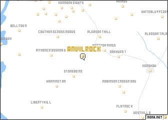
Anvil Rock (South Carolina, United States - USA)Anvil Rock is a town in the South Carolina region of United States - USA. An overview map of the region around Anvil Rock is displayed below.
regional and 3d topo map of Anvil Rock, United States - USA ::
Anvil Rock airports ::
The nearest airport is SSC - Sumter Shaw Afb, located 70.4 km south of Anvil Rock.
Other airports nearby include CLT - Charlotte Douglas Intl (74.1 km north), CAE - Colombia Columbia Metropolitan (79.5 km south west), FLO - Florence Rgnl (101.0 km south east), HKY - Hickory Rgnl (143.4 km north west), Nearby towns ::
Stoneboro (4.1km south west) //
Heath Springs (4.4km north east) //
Pleasant Hill (6.0km north east) //
Pitmon Crossroad (6.1km west) //
Oakhurst (6.5km east) //
Cauthens Crossroads (7.1km north west) //
Warrington (7.7km south west) //
Robinson Crossroad (8.8km south east) //
Jones Crossroads (9.8km north west) //
[all distances 'as the bird flies' and approximate] 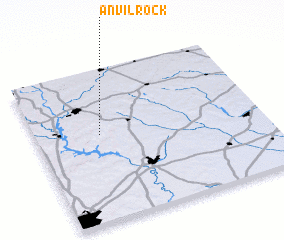 Places with similar names to Anvil Rock, United States - USA :: Disclaimer :: Information on this page comes without warranty of any kind |
||
|
Where is Anvil Rock? Elevation and coordinates ::
Latitude (lat): 34°34'23"N Longitude (lon): 80°43'1"W
Elevation (approx.): 203m (map arrows pan, magnifying glasses zoom) |
||
|
Visiting Anvil Rock? Hotel/Accommodation ::
Book a hotel in Anvil Rock Travel Guide ::
rental cars ::
car rental offers GPS waypoint ::
download a GPX waypoint (PoI) of Anvil Rock for your GPS receiver
|
||