|
search place name
|
||
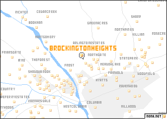
Brockington Heights (South Carolina, United States - USA)Brockington Heights is a town in the South Carolina region of United States - USA. An overview map of the region around Brockington Heights is displayed below.
regional and 3d topo map of Brockington Heights, United States - USA ::
Brockington Heights airports ::
The nearest airport is CAE - Colombia Columbia Metropolitan, located 18.5 km south of Brockington Heights.
Other airports nearby include SSC - Sumter Shaw Afb (56.1 km east), AGS - Bush Field Augusta Rgnl At Bush Fld (116.4 km south west), FLO - Florence Rgnl (123.5 km east), CLT - Charlotte Douglas Intl (124.3 km north), Nearby towns ::
Crane Forest (0.9km south east) //
Haskell Heights (1.6km south east) //
Rockgate (1.9km east) //
Evergreen Park (2.2km south east) //
Pine Forest (2.7km south east) //
Arlington Estates (2.8km north east) //
Lincolnshire (2.4km east) //
Northgate (2.6km east) //
Denny Terrace (3.6km south) //
Frost (3.5km south west) //
Dunston Hills (3.9km south) //
Fairfield Terrace (3.5km south east) //
Hollywood Hills (4.2km south east) //
Munster (5.0km south) //
Baronywood (5.1km south) //
Byrneswood (5.7km south) //
Kingswood (5.7km south west) //
Belmont (5.5km south east) //
Pine Valley (5.9km south west) //
Highland Forest (5.2km east) //
Broad River Estates (6.0km south west) //
Apple Valley (6.0km south west) //
Meadow Lake (5.5km south east) //
Emerald Valley (6.3km south) //
Mandel Hall (6.0km south west) //
Riverside Forest (6.8km south) //
Brook Pines (6.3km south west) //
Hyatts (6.7km south east) //
Eau Claire (7.2km south) //
[all distances 'as the bird flies' and approximate] 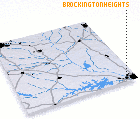 Places with similar names to Brockington Heights, United States - USA :: Disclaimer :: Information on this page comes without warranty of any kind |
||
|
Where is Brockington Heights? Elevation and coordinates ::
Latitude (lat): 34°5'52"N Longitude (lon): 81°3'32"W
Elevation (approx.): 109m (map arrows pan, magnifying glasses zoom) |
||
|
Visiting Brockington Heights? Hotel/Accommodation ::
Book a hotel in Brockington Heights Travel Guide ::
rental cars ::
car rental offers GPS waypoint ::
download a GPX waypoint (PoI) of Brockington Heights for your GPS receiver
|
||