|
search place name
|
||
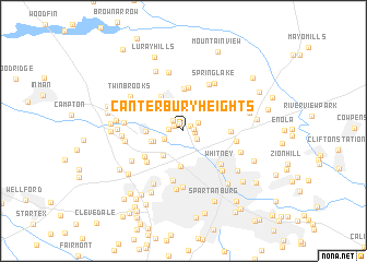
Canterbury Heights (South Carolina, United States - USA)Canterbury Heights is a town in the South Carolina region of United States - USA. An overview map of the region around Canterbury Heights is displayed below.
regional and 3d topo map of Canterbury Heights, United States - USA ::
Canterbury Heights airports ::
The nearest airport is AND - Andersen Anderson Rgnl, located 89.6 km south west of Canterbury Heights.
Other airports nearby include CLT - Charlotte Douglas Intl (95.4 km east), HKY - Hickory Rgnl (95.9 km north east), CAE - Colombia Columbia Metropolitan (142.2 km south east), SSC - Sumter Shaw Afb (179.1 km south east), Nearby towns ::
Mountainbrook (0.9km north west) //
Northbrook Park (0.8km north east) //
Shoally Creek (0.9km east) //
Quail Ridge (1.0km north west) //
North Hills (1.0km east) //
Midland Estates (1.4km north west) //
Valley Falls (1.3km west) //
Woodcreek (1.4km south east) //
Ferndale (1.5km north east) //
Thunderbird Mobile Home Park (1.8km south west) //
Spring Hills (2.4km north west) //
Sunnydale Acres (2.6km north east) //
Twin Creek (2.9km north) //
Panorama Estates (2.9km north) //
Lone Oak (3.0km south west) //
Peachtree Gardens (2.8km south west) //
Sherman Park (2.9km west) //
Hilltop (3.6km south) //
North Hill Acres (3.1km west) //
Boiling Springs (4.0km north west) //
Mason Estates (4.3km north) //
Laurelwood (4.4km north) //
Clearview Heights (4.0km north west) //
Lakeview Mobile Home Park (4.2km south west) //
Southern Shops (4.4km south west) //
Meadow Spring (4.0km east) //
Whitney (4.6km south east) //
Una (5.1km south) //
Carlisle (5.2km north east) //
[all distances 'as the bird flies' and approximate] 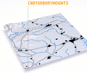 Places with similar names to Canterbury Heights, United States - USA :: Disclaimer :: Information on this page comes without warranty of any kind |
||
|
Where is Canterbury Heights? Elevation and coordinates ::
Latitude (lat): 35°0'52"N Longitude (lon): 81°57'40"W
Elevation (approx.): 259m (map arrows pan, magnifying glasses zoom) |
||
|
Visiting Canterbury Heights? Hotel/Accommodation ::
Book a hotel in Canterbury Heights Travel Guide ::
rental cars ::
car rental offers GPS waypoint ::
download a GPX waypoint (PoI) of Canterbury Heights for your GPS receiver
|
||