|
search place name
|
||
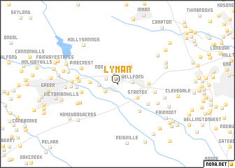
Lyman (South Carolina, United States - USA)Lyman is a town in the South Carolina region of United States - USA. An overview map of the region around Lyman is displayed below.
regional and 3d topo map of Lyman, United States - USA ::
Lyman airports ::
The nearest airport is AND - Andersen Anderson Rgnl, located 73.3 km south west of Lyman.
Other airports nearby include HKY - Hickory Rgnl (110.6 km north east), CLT - Charlotte Douglas Intl (112.0 km east), CAE - Colombia Columbia Metropolitan (145.3 km south east), AGS - Bush Field Augusta Rgnl At Bush Fld (175.7 km south), Nearby towns ::
Northview Acres (1.9km north) //
Harveytown (1.8km north west) //
Duncan (2.0km south west) //
Wellford (2.0km east) //
Holly Hill Heights (2.5km north west) //
Cheryl Fields (2.4km west) //
Startex (3.4km south east) //
Serene Heights (3.6km west) //
Jackson Mill (4.1km east) //
Holly Tree (5.1km south east) //
Brookside Village (5.2km south east) //
Tyger (4.9km west) //
Snoddy (5.1km east) //
Wade Hampton Heights (5.1km west) //
Pinecrest (5.3km north west) //
Brookdale (5.4km west) //
Calina Heights (5.3km west) //
Chapel Estates (5.7km south west) //
Larkin (6.1km south east) //
Manning Acres (6.1km south west) //
Palmetto Estates (6.0km west) //
Sunny Glen (6.1km west) //
Fairmont Mills (6.5km east) //
Gary Creek (6.9km north east) //
Zoar Heights (6.7km west) //
Fort Prince Farms (6.9km north east) //
Holly Springs (7.7km north west) //
Oakwood (6.9km west) //
Mount Zion (7.2km north east) //
[all distances 'as the bird flies' and approximate]  Places with similar names to Lyman, United States - USA ::
Disclaimer :: Information on this page comes without warranty of any kind |
||
|
Where is Lyman? Elevation and coordinates ::
Latitude (lat): 34°56'53"N Longitude (lon): 82°7'39"W
Elevation (approx.): 265m (map arrows pan, magnifying glasses zoom) |
||
|
Visiting Lyman? Hotel/Accommodation ::
Book a hotel in Lyman Travel Guide ::
rental cars ::
car rental offers GPS waypoint ::
download a GPX waypoint (PoI) of Lyman for your GPS receiver
|
||