|
search place name
|
||
Monaghan (South Carolina, United States - USA)Monaghan is a town in the South Carolina region of United States - USA. An overview map of the region around Monaghan is displayed below.
regional and 3d topo map of Monaghan, United States - USA ::

Monaghan airports ::
The nearest airport is AND - Andersen Anderson Rgnl, located 48.5 km south west of Monaghan.
Other airports nearby include HKY - Hickory Rgnl (135.6 km north east), CLT - Charlotte Douglas Intl (141.0 km east), CAE - Colombia Columbia Metropolitan (158.3 km south east), AGS - Bush Field Augusta Rgnl At Bush Fld (171.3 km south), Nearby towns ::
City View (0.5km south west) //
Riverside (0.6km north) //
Woodside (1.3km south) //
Hughes Heights (1.2km west) //
Poinsett (1.3km south west) //
Sans Souci (1.4km north) //
View Point Place (1.5km west) //
Woodbriar (1.8km west) //
Brandon (2.2km south) //
Park Place (1.9km east) //
Sampson (1.9km north east) //
Mansfield Park (2.2km south west) //
Westville (2.2km south west) //
West Greenville (2.5km south) //
Sunny Acres (2.4km west) //
Lockwood Heights (2.7km south west) //
Parker (2.8km south west) //
Farmington Acres (2.8km west) //
White Horse Heights (2.8km west) //
Sans Souci Heights (3.5km north) //
Judson (3.6km south) //
Berea (3.3km north west) //
Enchanted Forest (3.1km west) //
Leawood (3.7km north east) //
Greenville (3.5km south east) //
Berea Heights (3.7km north west) //
Westcliffe (3.6km west) //
Welcome (4.5km south) //
Dunean (4.6km south) //
[all distances 'as the bird flies' and approximate] 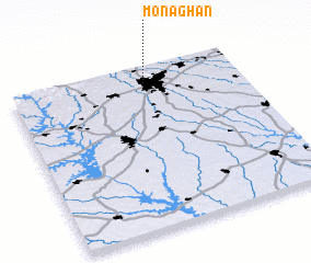 Places with similar names to Monaghan, United States - USA ::
Disclaimer :: Information on this page comes without warranty of any kind |
||
|
Where is Monaghan? Elevation and coordinates ::
Latitude (lat): 34°51'56"N Longitude (lon): 82°25'45"W
Elevation (approx.): 304m (map arrows pan, magnifying glasses zoom) |
||
|
Visiting Monaghan? Hotel/Accommodation ::
Book a hotel in Monaghan Travel Guide ::
rental cars ::
car rental offers GPS waypoint ::
download a GPX waypoint (PoI) of Monaghan for your GPS receiver
|
||