|
search place name
|
||
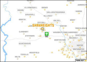
Shaw Heights (South Carolina, United States - USA)Shaw Heights is a town in the South Carolina region of United States - USA. An overview map of the region around Shaw Heights is displayed below.
regional and 3d topo map of Shaw Heights, United States - USA ::
Shaw Heights airports ::
The nearest airport is SSC - Sumter Shaw Afb, located 1.7 km south east of Shaw Heights.
Other airports nearby include CAE - Colombia Columbia Metropolitan (59.1 km west), FLO - Florence Rgnl (73.5 km east), CHS - Charleston Afb Intl (127.3 km south), CLT - Charlotte Douglas Intl (142.8 km north), Nearby towns ::
Home Acres (0.6km north east) //
Oakland (0.6km west) //
Pinckney Crossroad (1.5km north west) //
General Sumter Estates (2.1km south west) //
Carolina Mobile Home Park (2.4km south west) //
Marden Ranchettes (2.7km south west) //
Catchall (2.9km north) //
Springbank Hills (2.7km north west) //
Cherryvale (3.9km south east) //
Pecan Acres (4.4km north east) //
Hillcrest (5.9km north) //
Stateburg (5.7km south west) //
Sanders Corner (5.7km west) //
Dalzell (6.0km north east) //
Hearthstone (7.5km south east) //
Dinkins Mill (7.9km north west) //
Claremont (7.2km west) //
Swinton (7.2km east) //
Gaillard Crossroads (8.5km north east) //
North Deerfield (8.8km south east) //
Dixie Crossing (9.2km south west) //
Austin Acres (9.9km south east) //
Winter Park (10.0km south east) //
Summer View (10.2km south east) //
Sellars Heights (10.0km south east) //
Oak Haven Acres (10.4km south east) //
Park West (10.4km south east) //
Avondale (10.8km south east) //
[all distances 'as the bird flies' and approximate]  Places with similar names to Shaw Heights, United States - USA ::
// Chāh-e Taz (IR)
// Chahuites (MX)
// Chahuites (MX)
// Chahuites (MX)
// Ch'i-hu-tzu (TW)
// Chu-hu-tzu (TW)
// Shao-hui-tzu (TW)
Disclaimer :: Information on this page comes without warranty of any kind |
||
|
Where is Shaw Heights? Elevation and coordinates ::
Latitude (lat): 33°59'4"N Longitude (lon): 80°28'58"W
Elevation (approx.): 105m (map arrows pan, magnifying glasses zoom) |
||
|
Visiting Shaw Heights? Hotel/Accommodation ::
Book a hotel in Shaw Heights Travel Guide ::
rental cars ::
car rental offers GPS waypoint ::
download a GPX waypoint (PoI) of Shaw Heights for your GPS receiver
|
||