|
search place name
|
||
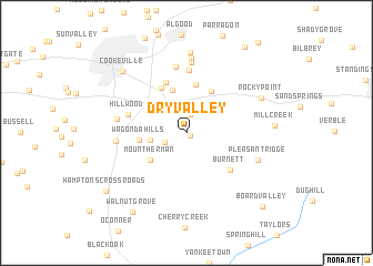
Dry Valley (Tennessee, United States - USA)Dry Valley is a town in the Tennessee region of United States - USA. An overview map of the region around Dry Valley is displayed below.
regional and 3d topo map of Dry Valley, United States - USA ::
Dry Valley airports ::
The nearest airport is BNA - Nashville Intl, located 111.1 km west of Dry Valley.
Other airports nearby include CHA - Chattanooga Lovell Fld (120.8 km south), TYS - Knoxville Mc Ghee Tyson (134.8 km east), HUA - Redstone Aaf (194.4 km south west), FTK - Fort Knox Godman Aaf (205.3 km north), Nearby towns ::
Goffton (0.4km south east) //
East Lake Estates (1.8km north) //
Maddux Farm (2.1km south west) //
Lake Valley (2.6km north) //
Poplar Estates (3.0km north) //
Woodland Estates (3.0km west) //
Mount Herman (4.0km south west) //
Winona (4.5km north) //
Wagonda Hills (3.9km west) //
Poplar Grove (4.6km north east) //
Buck Mountain Estates (4.9km north) //
Beverly Hills (5.0km north west) //
Burton Estates (5.4km north) //
Burnett (5.2km south east) //
Hillwood (5.1km west) //
Buck Lake Estates (6.4km north) //
White Plains (6.7km north) //
South Creek (5.8km west) //
Wilhite (5.8km west) //
Shenandoah Estates (7.1km north) //
Shennon Village (7.5km north) //
Pleasant Ridge (6.4km south east) //
Countryside Estates (8.1km north) //
Rocky Point (7.0km north east) //
Mill Creek (7.2km east) //
Cookeville (8.1km north west) //
Walnut Grove (9.1km south west) //
Hamptons Crossroads (8.8km south west) //
Mountain Meadows (9.9km north east) //
[all distances 'as the bird flies' and approximate]  Places with similar names to Dry Valley, United States - USA ::
// Turi-Vyla (RU)
// Tarovlu (AZ)
// Dry Valley (US)
// Dry Valley (US)
// Dörfli (CH)
// Dörfl (AT)
// Dörfl (AT)
// Dörfl (AT)
// Dörfl (AT)
// Dörfl (AT)
Disclaimer :: Information on this page comes without warranty of any kind |
||
|
Where is Dry Valley? Elevation and coordinates ::
Latitude (lat): 36°6'24"N Longitude (lon): 85°26'38"W
Elevation (approx.): 325m (map arrows pan, magnifying glasses zoom) |
||
|
Visiting Dry Valley? Hotel/Accommodation ::
Book a hotel in Dry Valley Travel Guide ::
rental cars ::
car rental offers GPS waypoint ::
download a GPX waypoint (PoI) of Dry Valley for your GPS receiver
|
||