|
search place name
|
||
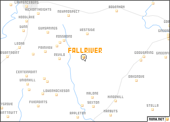
Fall River (Tennessee, United States - USA)Fall River is a town in the Tennessee region of United States - USA. An overview map of the region around Fall River is displayed below.
regional and 3d topo map of Fall River, United States - USA ::
Fall River airports ::
The nearest airport is HUA - Redstone Aaf, located 70.2 km south east of Fall River.
Other airports nearby include BNA - Nashville Intl (120.2 km north east), MKL - Jackson Mc Kellar Sipes Rgnl (162.7 km west), HOP - Hopkinsville Campbell Aaf (172.1 km north), BHM - Birmingham Intl (179.5 km south), Nearby towns ::
Revilo (4.6km west) //
Westside (6.0km north) //
Rossboro (5.9km north west) //
Crossroads (6.1km north west) //
Oak Hill (6.0km north west) //
Malone (8.1km south) //
Fairview (7.4km west) //
Idaho (8.2km south west) //
Lower Mockeson (9.0km south west) //
Gum Springs (9.2km north west) //
Minor Hill (10.4km south east) //
[all distances 'as the bird flies' and approximate]  Places with similar names to Fall River, United States - USA ::
// Villa Rivero (BO)
// Fowl River (US)
// Fall River (US)
// Fall River (US)
// Vleirivier (ZA)
// Fall River (US)
Disclaimer :: Information on this page comes without warranty of any kind |
||
|
Where is Fall River? Elevation and coordinates ::
Latitude (lat): 35°8'4"N Longitude (lon): 87°13'6"W
Elevation (approx.): 237m (map arrows pan, magnifying glasses zoom) |
||
|
Visiting Fall River? Hotel/Accommodation ::
Book a hotel in Fall River Travel Guide ::
rental cars ::
car rental offers GPS waypoint ::
download a GPX waypoint (PoI) of Fall River for your GPS receiver
|
||