|
search place name
|
||
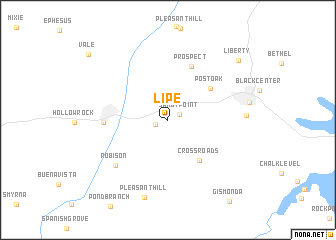
Lipe (Tennessee, United States - USA)Lipe is a town in the Tennessee region of United States - USA. An overview map of the region around Lipe is displayed below.
regional and 3d topo map of Lipe, United States - USA ::
Lipe airports ::
The nearest airport is MKL - Jackson Mc Kellar Sipes Rgnl, located 82.6 km south west of Lipe.
Other airports nearby include HOP - Hopkinsville Campbell Aaf (92.8 km north east), BNA - Nashville Intl (135.5 km east), BYH - Blytheville Arkansas Intl (159.3 km west), NQA - Millington Rgnl Jetport (170.8 km south west), Nearby towns ::
Sandy Point (1.2km north east) //
Sawyers Mill (1.2km south west) //
Crossroads (5.3km south east) //
Post Oak (5.2km north east) //
Prospect (6.4km north) //
Bruceton (5.9km west) //
Robison (6.9km south west) //
Tin Cup (7.1km east) //
Pleasant Hill (8.9km south) //
Liberty (9.2km north east) //
Vale (10.2km north west) //
[all distances 'as the bird flies' and approximate]  Places with similar names to Lipe, United States - USA ::
Disclaimer :: Information on this page comes without warranty of any kind |
||
|
Where is Lipe? Elevation and coordinates ::
Latitude (lat): 36°2'27"N Longitude (lon): 88°10'46"W
Elevation (approx.): 133m (map arrows pan, magnifying glasses zoom) |
||
|
Visiting Lipe? Hotel/Accommodation ::
Book a hotel in Lipe Travel Guide ::
rental cars ::
car rental offers GPS waypoint ::
download a GPX waypoint (PoI) of Lipe for your GPS receiver
|
||