|
search place name
|
||
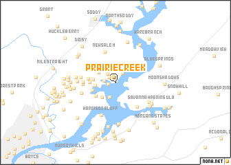
Prairie Creek (Tennessee, United States - USA)Prairie Creek is a town in the Tennessee region of United States - USA. An overview map of the region around Prairie Creek is displayed below.
regional and 3d topo map of Prairie Creek, United States - USA ::
Prairie Creek airports ::
The nearest airport is CHA - Chattanooga Lovell Fld, located 18.8 km south of Prairie Creek.
Other airports nearby include TYS - Knoxville Mc Ghee Tyson (124.2 km north east), HUA - Redstone Aaf (152.6 km west), MGE - Marietta Dobbins Arb (Atlanta Nas) (153.0 km south), BNA - Nashville Intl (173.5 km north west), Nearby towns ::
Blue Ridge View (0.8km north west) //
Prairie Peninsula (1.0km west) //
Dallas Branch (1.2km north west) //
Lakesite (1.8km north east) //
Dallas Hills (1.7km north west) //
Sequoyah Hills (1.6km west) //
Lake Dweller (2.6km south) //
Ridge Bay (2.9km south west) //
Dallas Gardens (2.8km north west) //
Lakeside Park (2.8km west) //
Dallas Hollow (3.0km west) //
Parkshore Estates (3.4km south west) //
Port Serena (3.3km west) //
Caramel Village (3.4km west) //
Green Cove (3.7km west) //
Middle Valley (4.3km west) //
Garden Farms (4.3km west) //
New Salem (5.2km north) //
Lake Crest (4.9km south east) //
Crabtree Hills (4.7km west) //
Harrison Bluff (5.6km south) //
Clearwater Acres (4.8km west) //
Pinetree Estates (5.0km west) //
Pinebrook Estates (5.4km south east) //
Cross Timbers (5.3km west) //
Waconda Point (6.8km south) //
Shady Grove Shores (6.7km north) //
Summer Haven (6.0km south east) //
Huntingdon Forest (5.6km west) //
[all distances 'as the bird flies' and approximate]  Places with similar names to Prairie Creek, United States - USA ::
Disclaimer :: Information on this page comes without warranty of any kind |
||
|
Where is Prairie Creek? Elevation and coordinates ::
Latitude (lat): 35°11'43"N Longitude (lon): 85°8'14"W
Elevation (approx.): 240m (map arrows pan, magnifying glasses zoom) |
||
|
Visiting Prairie Creek? Hotel/Accommodation ::
Book a hotel in Prairie Creek Travel Guide ::
rental cars ::
car rental offers GPS waypoint ::
download a GPX waypoint (PoI) of Prairie Creek for your GPS receiver
|
||