|
search place name
|
||
Westmoreland Heights (Tennessee, United States - USA)Westmoreland Heights is a town in the Tennessee region of United States - USA. An overview map of the region around Westmoreland Heights is displayed below.
regional and 3d topo map of Westmoreland Heights, United States - USA ::

Westmoreland Heights airports ::
The nearest airport is TYS - Knoxville Mc Ghee Tyson, located 12.4 km south of Westmoreland Heights.
Other airports nearby include CHA - Chattanooga Lovell Fld (146.7 km south west), AND - Andersen Anderson Rgnl (197.5 km south east), FTK - Fort Knox Godman Aaf (281.5 km north west), Nearby towns ::
Bearden (1.2km north) //
Rothwood (1.3km south west) //
Lyons View (1.4km north east) //
Deane Hill (1.5km north west) //
Westminister Ridge (1.9km south east) //
Hickory Hills (2.2km south west) //
Westlyn (2.2km west) //
Lakemoor Hills (2.3km east) //
Rocky Hill (2.6km south west) //
Forest Hills (2.8km north east) //
Mockingbird Hill (3.1km south east) //
Timbercrest (3.5km north) //
Sequoyah Hills (3.1km north east) //
Northshore Woods (3.5km south west) //
Galewood (3.5km south west) //
Aldenwood Park (3.7km south west) //
Kingston Hills (3.3km west) //
Middlebrook Heights (4.0km north) //
Woodland Acres (3.6km south west) //
Montvue (3.4km west) //
Riverbend (3.9km south east) //
Westavia Woods (3.9km north west) //
Timberlake (3.7km east) //
Kingston Woods (3.9km south west) //
West Hills (4.0km west) //
Amherst (4.7km north west) //
Trails West (4.3km west) //
Third Creek (5.4km north) //
Marble City (5.0km north east) //
[all distances 'as the bird flies' and approximate] 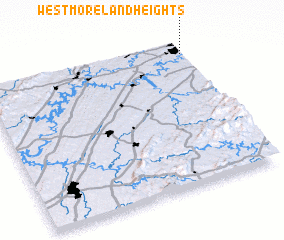 Places with similar names to Westmoreland Heights, United States - USA ::
// Westmoreland Heights (US)
Disclaimer :: Information on this page comes without warranty of any kind |
||
|
Where is Westmoreland Heights? Elevation and coordinates ::
Latitude (lat): 35°55'19"N Longitude (lon): 84°0'18"W
Elevation (approx.): 278m (map arrows pan, magnifying glasses zoom) |
||
|
Visiting Westmoreland Heights? Hotel/Accommodation ::
Book a hotel in Westmoreland Heights Travel Guide ::
rental cars ::
car rental offers GPS waypoint ::
download a GPX waypoint (PoI) of Westmoreland Heights for your GPS receiver
|
||