|
search place name
|
||
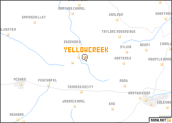
Yellow Creek (Tennessee, United States - USA)Yellow Creek is a town in the Tennessee region of United States - USA. An overview map of the region around Yellow Creek is displayed below.
regional and 3d topo map of Yellow Creek, United States - USA ::
Yellow Creek airports ::
The nearest airport is HOP - Hopkinsville Campbell Aaf, located 57.2 km north of Yellow Creek.
Other airports nearby include BNA - Nashville Intl (74.5 km east), MKL - Jackson Mc Kellar Sipes Rgnl (141.4 km south west), HUA - Redstone Aaf (179.7 km south east), FTK - Fort Knox Godman Aaf (237.7 km north east), Nearby towns ::
Ruskin (1.6km north west) //
Thompsons Crossroads (2.4km west) //
Adams Crossroads (3.5km north west) //
Edgewood (4.0km north west) //
Tennessee City (6.7km south) //
Hortense (6.6km east) //
Sylvia (7.4km east) //
Taylor Crossroads (8.1km north east) //
Few Chapel (8.4km south west) //
Pond (8.7km south east) //
[all distances 'as the bird flies' and approximate] 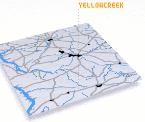 Places with similar names to Yellow Creek, United States - USA ::
// Yellow Creek (US)
// Yellow Creek (US)
// Yellow Creek (US)
// Yellow Creek (US)
// Yellow Creek (US)
// Yellow Creek (US)
Disclaimer :: Information on this page comes without warranty of any kind |
||
|
Where is Yellow Creek? Elevation and coordinates ::
Latitude (lat): 36°9'10"N Longitude (lon): 87°30'18"W
Elevation (approx.): 178m (map arrows pan, magnifying glasses zoom) |
||
|
Visiting Yellow Creek? Hotel/Accommodation ::
Book a hotel in Yellow Creek Travel Guide ::
rental cars ::
car rental offers GPS waypoint ::
download a GPX waypoint (PoI) of Yellow Creek for your GPS receiver
|
||