|
search place name
|
||
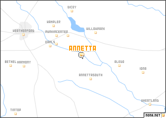
Annetta (Texas, United States - USA)Annetta is a town in the Texas region of United States - USA. An overview map of the region around Annetta is displayed below.
regional and 3d topo map of Annetta, United States - USA ::
Annetta airports ::
The nearest airport is FTW - Fort Worth Meacham Intl, located 31.8 km north east of Annetta.
Other airports nearby include DFW - Dallas-fort Worth Dallas Fort Worth Intl (63.3 km east), DAL - Dallas Love Fld (78.7 km east), ACT - Waco Rgnl (128.8 km south), SPS - Sheppard Afb Wichita Falls Muni (161.0 km north west), Nearby towns ::
Annetta North (1.1km north) //
Annetta South (4.8km south) //
Hudson Oaks (6.0km north west) //
Willow Park (6.4km north) //
Center Point (6.1km north west) //
Punkin Center (7.3km north west) //
Earls (6.9km north west) //
Aledo (7.1km east) //
Wampler (9.4km north west) //
[all distances 'as the bird flies' and approximate] 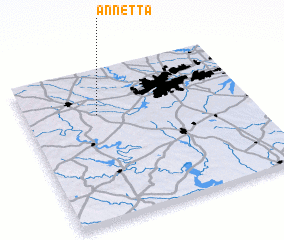 Places with similar names to Annetta, United States - USA ::
Disclaimer :: Information on this page comes without warranty of any kind |
||
|
Where is Annetta? Elevation and coordinates ::
Latitude (lat): 32°42'33"N Longitude (lon): 97°40'33"W
Elevation (approx.): 274m (map arrows pan, magnifying glasses zoom) |
||
|
Visiting Annetta? Hotel/Accommodation ::
Book a hotel in Annetta Travel Guide ::
rental cars ::
car rental offers GPS waypoint ::
download a GPX waypoint (PoI) of Annetta for your GPS receiver
|
||