|
search place name
|
||
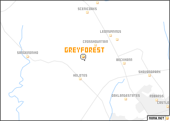
Grey Forest (Texas, United States - USA)Grey Forest is a town in the Texas region of United States - USA. An overview map of the region around Grey Forest is displayed below.
regional and 3d topo map of Grey Forest, United States - USA ::
Grey Forest airports ::
The nearest airport is SAT - San Antonio Intl, located 22.3 km south east of Grey Forest.
Other airports nearby include SKF - San Antonio Lackland Afb Kelly Fld Annex (27.4 km south), RND - San Antonio Randolph Afb (40.1 km east), AUS - Austin Bergstrom Intl (116.8 km north east), GRK - Killeen Robert Gray Aaf (180.6 km north east), Nearby towns ::
Cross Mountain (3.9km north east) //
Helotes (4.3km south) //
Leon Springs (7.4km north east) //
Dominion (7.7km north east) //
Beckmann (7.6km east) //
[all distances 'as the bird flies' and approximate] 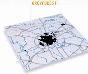 Places with similar names to Grey Forest, United States - USA ::
Disclaimer :: Information on this page comes without warranty of any kind |
||
|
Where is Grey Forest? Elevation and coordinates ::
Latitude (lat): 29°36'55"N Longitude (lon): 98°40'50"W
Elevation (approx.): 346m (map arrows pan, magnifying glasses zoom) |
||
|
Visiting Grey Forest? Hotel/Accommodation ::
Book a hotel in Grey Forest Travel Guide ::
rental cars ::
car rental offers GPS waypoint ::
download a GPX waypoint (PoI) of Grey Forest for your GPS receiver
|
||