|
search place name
|
||
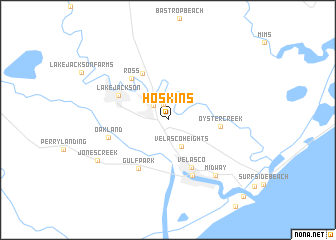
Hoskins (Texas, United States - USA)Hoskins is a town in the Texas region of United States - USA. An overview map of the region around Hoskins is displayed below.
regional and 3d topo map of Hoskins, United States - USA ::
Hoskins airports ::
The nearest airport is GLS - Scholes Intl At Galveston, located 58.3 km north east of Hoskins.
Other airports nearby include HOU - Houston William P Hobby (71.2 km north), IAH - George Bush Intcntl Houston (108.2 km north), CXO - Conroe Lone Star Executive (148.8 km north), BPT - Beaumont Southeast Texas Rgnl (168.4 km north east), Nearby towns ::
Lake Barbara (1.8km north) //
Clute (2.2km north west) //
Velasco Heights (3.2km south east) //
Oyster Creek (5.2km east) //
Richwood (5.7km north west) //
Velasco (5.8km south east) //
Ross (5.8km north west) //
Lake Jackson (5.6km north west) //
Gulf Park (6.1km south west) //
Freeport (6.6km south) //
Oakland (6.1km west) //
Midway (7.7km south east) //
Jones Creek (8.3km south west) //
Quintana (11.3km south east) //
[all distances 'as the bird flies' and approximate]  Places with similar names to Hoskins, United States - USA ::
// Hoskins (US)
// Haskins (US)
// Hoskins (US)
// Hoskins (US)
// Haskins (US)
// Hoskins (US)
// Hoskins (US)
// Hoskins (PG)
// Huissignies (BE)
// Haw Sakanhsa (MM)
Disclaimer :: Information on this page comes without warranty of any kind |
||
|
Where is Hoskins? Elevation and coordinates ::
Latitude (lat): 29°0'34"N Longitude (lon): 95°23'3"W
Elevation (approx.): 4m (map arrows pan, magnifying glasses zoom) |
||
|
Visiting Hoskins? Hotel/Accommodation ::
Book a hotel in Hoskins Travel Guide ::
rental cars ::
car rental offers GPS waypoint ::
download a GPX waypoint (PoI) of Hoskins for your GPS receiver
|
||