|
search place name
|
||
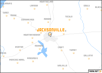
Jacksonville (Texas, United States - USA)Jacksonville is a town in the Texas region of United States - USA. An overview map of the region around Jacksonville is displayed below.
regional and 3d topo map of Jacksonville, United States - USA ::
Jacksonville airports ::
The nearest airport is TYR - Tyler Pounds Rgnl, located 45.1 km north of Jacksonville.
Other airports nearby include GGG - Longview East Texas Rgnl (70.4 km north east), SHV - Shreveport Rgnl (146.4 km east), BAD - Shreveport Barksdale Afb (162.9 km east), DAL - Dallas Love Fld (178.1 km north west), Nearby towns ::
Lake View (3.4km north west) //
Mittie (4.0km east) //
Pomona (5.4km north) //
New Hope (5.7km south west) //
Craft (6.0km south east) //
Mountain Heaven (5.8km west) //
Hume (6.2km west) //
Tecula (8.5km north east) //
Cove Springs (8.8km north west) //
Turney (9.4km south east) //
[all distances 'as the bird flies' and approximate]  Places with similar names to Jacksonville, United States - USA ::
// Jacksonville (US)
// Jacksonville (US)
// Jacksonville (US)
// Jacksonville (US)
// Jacksonville (US)
// Jacksonville (US)
// Jacksonville (US)
// Jacksonville (US)
// Jacksonville (US)
// Jacksonville (US)
Disclaimer :: Information on this page comes without warranty of any kind |
||
|
Where is Jacksonville? Elevation and coordinates ::
Latitude (lat): 31°57'49"N Longitude (lon): 95°16'13"W
Elevation (approx.): 159m (map arrows pan, magnifying glasses zoom) |
||
|
Visiting Jacksonville? Hotel/Accommodation ::
Book a hotel in Jacksonville Travel Guide ::
rental cars ::
car rental offers GPS waypoint ::
download a GPX waypoint (PoI) of Jacksonville for your GPS receiver
|
||