|
search place name
|
||
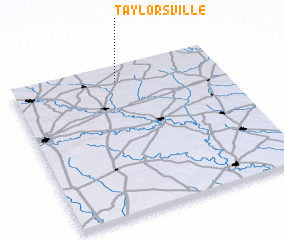
Taylorsville (Texas, United States - USA)Taylorsville is a town in the Texas region of United States - USA. An overview map of the region around Taylorsville is displayed below.
regional and 3d topo map of Taylorsville, United States - USA ::

Taylorsville airports ::
The nearest airport is AUS - Austin Bergstrom Intl, located 37.0 km north west of Taylorsville.
Other airports nearby include RND - San Antonio Randolph Afb (85.8 km south west), SAT - San Antonio Intl (102.3 km south west), SKF - San Antonio Lackland Afb Kelly Fld Annex (119.2 km south west), CLL - College Station Easterwood Fld (133.5 km north east), Nearby towns ::
 Places with similar names to Taylorsville, United States - USA ::
// Taylorsville (US)
// Taylorsville (US)
// Taylorsville (US)
// Taylorsville (US)
// Taylorsville (US)
// Taylorsville (US)
// Taylorsville (US)
// Taylorsville (US)
// Tylersville (US)
// Taylorsville (US)
Disclaimer :: Information on this page comes without warranty of any kind |
||
|
Where is Taylorsville? Elevation and coordinates ::
Latitude (lat): 29°53'45"N Longitude (lon): 97°29'52"W
Elevation (approx.): 166m (map arrows pan, magnifying glasses zoom) |
||
|
Visiting Taylorsville? Hotel/Accommodation ::
Book a hotel in Taylorsville Travel Guide ::
rental cars ::
car rental offers GPS waypoint ::
download a GPX waypoint (PoI) of Taylorsville for your GPS receiver
|
||