|
search place name
|
||
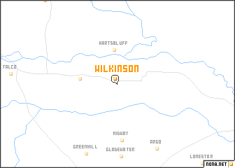
Wilkinson (Texas, United States - USA)Wilkinson is a town in the Texas region of United States - USA. An overview map of the region around Wilkinson is displayed below.
regional and 3d topo map of Wilkinson, United States - USA ::
Wilkinson airports ::
The nearest airport is TXK - Texarkana Rgnl Webb Fld, located 90.1 km east of Wilkinson.
Other airports nearby include GGG - Longview East Texas Rgnl (109.3 km south), TYR - Tyler Pounds Rgnl (118.1 km south), SHV - Shreveport Rgnl (145.2 km south east), BAD - Shreveport Barksdale Afb (152.8 km south east), Nearby towns ::
Harts Bluff (5.5km north) //
Maple Springs (5.1km west) //
[all distances 'as the bird flies' and approximate] 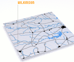 Places with similar names to Wilkinson, United States - USA ::
Disclaimer :: Information on this page comes without warranty of any kind |
||
|
Where is Wilkinson? Elevation and coordinates ::
Latitude (lat): 33°20'54"N Longitude (lon): 94°57'5"W
Elevation (approx.): 104m (map arrows pan, magnifying glasses zoom) |
||
|
Visiting Wilkinson? Hotel/Accommodation ::
Book a hotel in Wilkinson Travel Guide ::
rental cars ::
car rental offers GPS waypoint ::
download a GPX waypoint (PoI) of Wilkinson for your GPS receiver
|
||