|
search place name
|
||
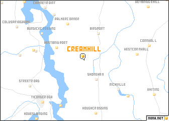
Cream Hill (Vermont, United States - USA)Cream Hill is a town in the Vermont region of United States - USA. An overview map of the region around Cream Hill is displayed below.
regional and 3d topo map of Cream Hill, United States - USA ::
Cream Hill airports ::
The nearest airport is BTV - Burlington Intl, located 61.9 km north of Cream Hill.
Other airports nearby include ALB - Albany Intl (136.7 km south), YJN - St. Jean St Jean (151.5 km north), MSS - Massena Intl Richards Fld (163.8 km north west), YUL - Montreal Pierre Elliott Trudeau Intl (174.0 km north), Nearby towns ::
Shoreham (4.6km south east) //
Birdport (6.3km north) //
West Bridport (5.3km north west) //
Palmer Corner (8.5km north) //
Richville (8.4km south east) //
[all distances 'as the bird flies' and approximate]  Places with similar names to Cream Hill, United States - USA ::
// Chrome Hill (US)
// Graeme Hall (BB)
// Garai Mahāl (BD)
// Karīm Maḩalleh (IR)
// Qārī Maḩalleh (IR)
// Cromhall (GB)
// Ćar Mahala (CS)
// Car-Mahala (CS)
// Guri Mahala (CS)
Disclaimer :: Information on this page comes without warranty of any kind |
||
|
Where is Cream Hill? Elevation and coordinates ::
Latitude (lat): 43°55'53"N Longitude (lon): 73°20'25"W
Elevation (approx.): 101m (map arrows pan, magnifying glasses zoom) |
||
|
Visiting Cream Hill? Hotel/Accommodation ::
Book a hotel in Cream Hill Travel Guide ::
rental cars ::
car rental offers GPS waypoint ::
download a GPX waypoint (PoI) of Cream Hill for your GPS receiver
|
||