|
search place name
|
||
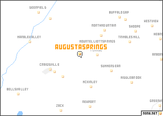
Augusta Springs (Virginia, United States - USA)Augusta Springs is a town in the Virginia region of United States - USA. An overview map of the region around Augusta Springs is displayed below.
regional and 3d topo map of Augusta Springs, United States - USA ::
Augusta Springs airports ::
The nearest airport is EKN - Elkins Randolph Co Jennings Randolph, located 99.3 km north west of Augusta Springs.
Other airports nearby include IAD - Washington Dulles Intl (187.4 km north east), RIC - Richmond Intl (188.1 km east), INT - Winston-salem Smith Reynolds (232.7 km south), Nearby towns ::
Ferrol (3.0km east) //
Mount Elliott Springs (4.1km north east) //
Estaline (5.5km south west) //
Chapin (6.3km north east) //
McKinley (6.8km south) //
Fordwick (5.8km south west) //
Summerdean (6.2km south east) //
Craigsville (6.3km south west) //
North Mountain (7.7km north east) //
[all distances 'as the bird flies' and approximate]  Places with similar names to Augusta Springs, United States - USA :: Disclaimer :: Information on this page comes without warranty of any kind |
||
|
Where is Augusta Springs? Elevation and coordinates ::
Latitude (lat): 38°6'7"N Longitude (lon): 79°19'6"W
Elevation (approx.): 497m (map arrows pan, magnifying glasses zoom) |
||
|
Visiting Augusta Springs? Hotel/Accommodation ::
Book a hotel in Augusta Springs Travel Guide ::
rental cars ::
car rental offers GPS waypoint ::
download a GPX waypoint (PoI) of Augusta Springs for your GPS receiver
|
||