|
search place name
|
||
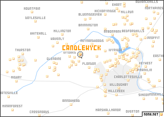
Candlewyck (Virginia, United States - USA)Candlewyck is a town in the Virginia region of United States - USA. An overview map of the region around Candlewyck is displayed below.
regional and 3d topo map of Candlewyck, United States - USA ::
Candlewyck airports ::
The nearest airport is RIC - Richmond Intl, located 127.1 km south east of Candlewyck.
Other airports nearby include IAD - Washington Dulles Intl (137.1 km north east), EKN - Elkins Randolph Co Jennings Randolph (144.1 km north west), DCA - Ronald Reagan Washington Natl (159.3 km north east), ADW - Camp Springs Andrews Afb (Washington Dc Naf) (169.8 km north east), Nearby towns ::
Ballard Woods (0.4km north west) //
West Leigh (0.9km south west) //
West Woods (1.3km west) //
Loch Leigh (1.8km south west) //
Lewis Hill East (1.8km south west) //
Lewis Hill West (1.9km west) //
Flordon (2.5km south east) //
Ivy Oaks (2.2km west) //
Meriwether Hill (2.4km south west) //
Owensville (3.0km north) //
Whipporwill Hollow (2.8km north west) //
Ivy (3.0km south west) //
Inglecress (2.8km east) //
Reynard Woods (3.7km north east) //
Farmington (3.6km south east) //
Ednam Forest (3.9km south east) //
Ednam (3.9km south east) //
Mill Ridge (4.2km north west) //
Ednam Village (4.2km south east) //
Colthurst (4.2km east) //
Ivy Farms (4.5km east) //
Stillfield (4.6km east) //
Whispering Pines (4.8km west) //
Bellair (5.3km south east) //
Liberty Hill (5.7km south east) //
Glenaire (5.1km west) //
Huntington Village (5.4km south east) //
Montvue (5.1km east) //
Ivy Meadows (5.3km south west) //
[all distances 'as the bird flies' and approximate]  Places with similar names to Candlewyck, United States - USA ::
// Candalaga (PH)
// Canitlog (PH)
// Gana Długa (PL)
// Kändliku (EE)
// Kandilköy (TR)
// Kandalik (RU)
// Kuntulik (RU)
// Candlewyck (US)
// Conneaut Lake (US)
// Gondologo (BF)
Disclaimer :: Information on this page comes without warranty of any kind |
||
|
Where is Candlewyck? Elevation and coordinates ::
Latitude (lat): 38°4'28"N Longitude (lon): 78°34'20"W
Elevation (approx.): 169m (map arrows pan, magnifying glasses zoom) |
||
|
Visiting Candlewyck? Hotel/Accommodation ::
Book a hotel in Candlewyck Travel Guide ::
rental cars ::
car rental offers GPS waypoint ::
download a GPX waypoint (PoI) of Candlewyck for your GPS receiver
|
||