|
search place name
|
||
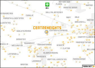
Centre Heights (Virginia, United States - USA)Centre Heights is a town in the Virginia region of United States - USA. An overview map of the region around Centre Heights is displayed below.
regional and 3d topo map of Centre Heights, United States - USA ::
Centre Heights airports ::
The nearest airport is IAD - Washington Dulles Intl, located 11.5 km north of Centre Heights.
Other airports nearby include DCA - Ronald Reagan Washington Natl (36.3 km east), ADW - Camp Springs Andrews Afb (Washington Dc Naf) (51.2 km east), BWI - Baltimore Washington Intl (77.6 km north east), NHK - Patuxent River Nas (109.8 km south east), Nearby towns ::
London Towne (0.3km south west) //
Uniontown (2.2km south) //
Centreville (2.3km east) //
Comptons Corner (3.5km south) //
Centreville Farms (3.5km east) //
Bull Run Mobile Home Park (5.2km south) //
Breeden Forest (5.3km south) //
Yorkshire (5.3km south) //
Yorkshire Park (5.4km south) //
Stoneridge (5.5km south) //
Willow Springs (4.4km east) //
Yorkshire Village (5.6km south) //
Schneider Crossroads (5.2km north west) //
Brookfield (5.4km north east) //
Cedar Park (5.7km south) //
Sudley Square (6.1km south west) //
Chantilly (6.3km north) //
Manassas Park (6.5km south) //
Yorkshire Acres (6.5km south) //
Loch Lomond (6.4km south) //
Edgelea (5.7km south east) //
Greenbriar (5.9km north east) //
Sudley (6.5km south west) //
Cloverleaf Farm Estates (6.2km south east) //
West Gate of Lomond (6.9km south west) //
Ivakota (6.9km south east) //
Bull Run East (7.0km south west) //
Sully Plantation (7.7km north) //
Crystal Springs (6.2km east) //
[all distances 'as the bird flies' and approximate]  Places with similar names to Centre Heights, United States - USA :: Disclaimer :: Information on this page comes without warranty of any kind |
||
|
Where is Centre Heights? Elevation and coordinates ::
Latitude (lat): 38°50'27"N Longitude (lon): 77°27'19"W
Elevation (approx.): 79m (map arrows pan, magnifying glasses zoom) |
||
|
Visiting Centre Heights? Hotel/Accommodation ::
Book a hotel in Centre Heights Travel Guide ::
rental cars ::
car rental offers GPS waypoint ::
download a GPX waypoint (PoI) of Centre Heights for your GPS receiver
|
||