|
search place name
|
||
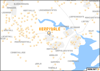
Kerrydale (Virginia, United States - USA)Kerrydale is a town in the Virginia region of United States - USA. An overview map of the region around Kerrydale is displayed below.
regional and 3d topo map of Kerrydale, United States - USA ::
Kerrydale airports ::
The nearest airport is IAD - Washington Dulles Intl, located 32.5 km north of Kerrydale.
Other airports nearby include DCA - Ronald Reagan Washington Natl (33.9 km north east), ADW - Camp Springs Andrews Afb (Washington Dc Naf) (44.7 km east), BWI - Baltimore Washington Intl (81.6 km north east), NHK - Patuxent River Nas (91.7 km south east), Nearby towns ::
Hillendale (0.9km east) //
Laurel Hills (1.4km north east) //
Glendale (1.4km south east) //
Lindendale (1.7km south west) //
Hoadly (2.1km north west) //
Mapledale (2.3km south west) //
Minnieville Estates (2.7km south) //
Elm Farm Mobile Home Park (2.2km east) //
Colony Woods (2.9km south) //
Minnieville (3.3km south) //
Evansdale (3.3km south) //
Forestdale (3.1km south east) //
Darbydale (3.8km south east) //
Ridgedale (3.4km south west) //
Silverdale (3.7km south west) //
Princedale (3.4km west) //
Bethel (3.5km east) //
Neabsco Hills (4.5km south) //
Birchdale (4.2km south east) //
Barksdale (4.4km south east) //
Dale City (4.3km south east) //
Orangedale (4.0km west) //
Cloverdale (4.9km south) //
Devonshire (4.4km south west) //
Terrapin Forest (4.5km west) //
Lake Ridge (4.9km north east) //
Carriage Hill Estates (4.8km west) //
Montclair (6.0km south) //
Gleatons Mobile Home Park (4.8km east) //
[all distances 'as the bird flies' and approximate]  Places with similar names to Kerrydale, United States - USA ::
Disclaimer :: Information on this page comes without warranty of any kind |
||
|
Where is Kerrydale? Elevation and coordinates ::
Latitude (lat): 38°39'54"N Longitude (lon): 77°20'45"W
Elevation (approx.): 86m (map arrows pan, magnifying glasses zoom) |
||
|
Visiting Kerrydale? Hotel/Accommodation ::
Book a hotel in Kerrydale Travel Guide ::
rental cars ::
car rental offers GPS waypoint ::
download a GPX waypoint (PoI) of Kerrydale for your GPS receiver
|
||