|
search place name
|
||
Loudoun Heights (Virginia, United States - USA)Loudoun Heights is a town in the Virginia region of United States - USA. An overview map of the region around Loudoun Heights is displayed below.
regional and 3d topo map of Loudoun Heights, United States - USA ::

Loudoun Heights airports ::
The nearest airport is IAD - Washington Dulles Intl, located 46.8 km south east of Loudoun Heights.
Other airports nearby include DCA - Ronald Reagan Washington Natl (78.0 km south east), BWI - Baltimore Washington Intl (91.9 km east), ADW - Camp Springs Andrews Afb (Washington Dc Naf) (92.4 km south east), AOO - Altoona Blair Co (120.7 km north west), Nearby towns ::
Sandy Hook (1.6km north east) //
Lower Town (1.5km north west) //
Harpers Ferry (2.3km north west) //
Pleasantville (3.4km north west) //
Bolivar (3.2km west) //
Silver Grove (3.3km south west) //
Weverton (3.8km north east) //
Garretts Mill (5.2km north east) //
Pine Hill Estates (4.8km north east) //
Neersville (5.8km south) //
Knoxville (4.9km east) //
Pomona (5.5km south east) //
Samples Manor (6.6km north) //
Roelkeys Knoll (5.5km north east) //
Elvan (5.8km south east) //
Georges Mill (5.5km south east) //
Blue Ridge Acres (5.6km south west) //
Britain (6.9km south) //
Dargan (7.3km north) //
Keyes Ferry Acres (6.1km south west) //
Water Acres (7.1km north) //
Bakerton (6.8km north west) //
Keys Gap (7.1km south west) //
Augusta (7.1km north east) //
Yarrowsburg (7.4km north east) //
Engle (6.5km north west) //
Millville (6.2km west) //
New Addition (6.2km east) //
Potomac Vistas (8.8km north) //
[all distances 'as the bird flies' and approximate] 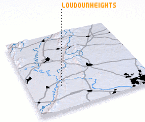 Places with similar names to Loudoun Heights, United States - USA ::
// Loudon Heights (US)
Disclaimer :: Information on this page comes without warranty of any kind |
||
|
Where is Loudoun Heights? Elevation and coordinates ::
Latitude (lat): 39°18'47"N Longitude (lon): 77°43'5"W
Elevation (approx.): 129m (map arrows pan, magnifying glasses zoom) |
||
|
Visiting Loudoun Heights? Hotel/Accommodation ::
Book a hotel in Loudoun Heights Travel Guide ::
rental cars ::
car rental offers GPS waypoint ::
download a GPX waypoint (PoI) of Loudoun Heights for your GPS receiver
|
||