|
search place name
|
||
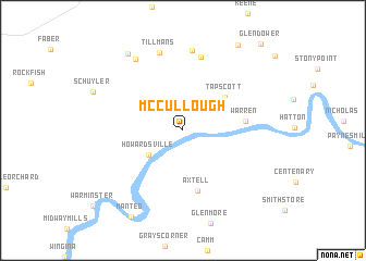
McCullough (Virginia, United States - USA)McCullough is a town in the Virginia region of United States - USA. An overview map of the region around McCullough is displayed below.
regional and 3d topo map of McCullough, United States - USA ::
McCullough airports ::
The nearest airport is RIC - Richmond Intl, located 117.8 km east of McCullough.
Other airports nearby include EKN - Elkins Randolph Co Jennings Randolph (166.1 km north west), IAD - Washington Dulles Intl (166.3 km north east), DCA - Ronald Reagan Washington Natl (183.9 km north east), ADW - Camp Springs Andrews Afb (Washington Dc Naf) (192.6 km north east), Nearby towns ::
Boiling Spring (3.5km north east) //
Howardsville (3.8km south west) //
Tapscott (4.8km north east) //
Axtell (6.3km south) //
Warren (5.2km east) //
Porters (7.7km north) //
Esmont (8.3km north) //
Tillmans (8.2km north) //
Damon (8.3km north west) //
Old Dominion (9.0km north west) //
Browntown (9.9km north east) //
[all distances 'as the bird flies' and approximate] 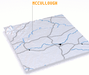 Places with similar names to McCullough, United States - USA ::
Disclaimer :: Information on this page comes without warranty of any kind |
||
|
Where is McCullough? Elevation and coordinates ::
Latitude (lat): 37°45'25"N Longitude (lon): 78°36'56"W
Elevation (approx.): 97m (map arrows pan, magnifying glasses zoom) |
||
|
Visiting McCullough? Hotel/Accommodation ::
Book a hotel in McCullough Travel Guide ::
rental cars ::
car rental offers GPS waypoint ::
download a GPX waypoint (PoI) of McCullough for your GPS receiver
|
||