|
search place name
|
||
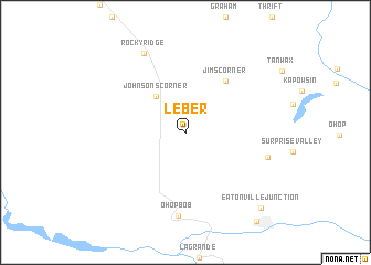
Leber (Washington, United States - USA)Leber is a town in the Washington region of United States - USA. An overview map of the region around Leber is displayed below.
regional and 3d topo map of Leber, United States - USA ::
Leber airports ::
The nearest airport is TCM - Tacoma Mc Chord Afb, located 23.8 km north west of Leber.
Other airports nearby include GRF - Fort Lewis Gray Aaf (24.0 km north west), SEA - Seattle Tacoma Intl (55.7 km north), BFI - Seattle Boeing Fld King Co Intl (64.7 km north), PAE - Everett Snohomish Co (106.6 km north), Nearby towns ::
Johnsons Corner (4.1km north west) //
Jims Corner (5.9km north east) //
Ohop Bob (8.5km south) //
Clay City (6.2km south east) //
Rocky Ridge (8.5km north) //
Eatonville Junction (9.3km south east) //
[all distances 'as the bird flies' and approximate] 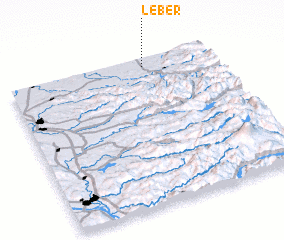 Places with similar names to Leber, United States - USA ::
Disclaimer :: Information on this page comes without warranty of any kind |
||
|
Where is Leber? Elevation and coordinates ::
Latitude (lat): 46°56'54"N Longitude (lon): 122°19'48"W
Elevation (approx.): 211m (map arrows pan, magnifying glasses zoom) |
||
|
Visiting Leber? Hotel/Accommodation ::
Book a hotel in Leber Travel Guide ::
rental cars ::
car rental offers GPS waypoint ::
download a GPX waypoint (PoI) of Leber for your GPS receiver
|
||