|
search place name
|
||
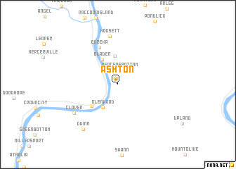
Ashton (West Virginia, United States - USA)Ashton is a town in the West Virginia region of United States - USA. An overview map of the region around Ashton is displayed below.
regional and 3d topo map of Ashton, United States - USA ::
Ashton airports ::
The nearest airport is LCK - Columbus Rickenbacker Intl, located 147.6 km north west of Ashton.
Other airports nearby include CMH - Port Columbus Intl (164.9 km north), FFO - Dayton Wright Patterson Afb (210.4 km north west), PIT - Pittsburgh (pennsylva) Pittsburgh Intl (265.6 km north east), Nearby towns ::
Mercers Bottom (2.3km north) //
Glenwood (4.1km south west) //
Apple Grove (4.6km north) //
Bladen (4.4km north west) //
Swan Creek (4.7km south west) //
Eureka (6.3km north) //
Hogsett (7.7km north) //
Clover (7.1km south west) //
Gwinn (8.3km south west) //
[all distances 'as the bird flies' and approximate] 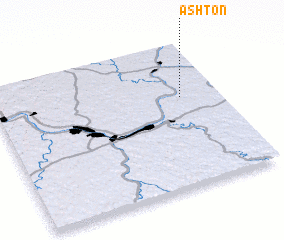 Places with similar names to Ashton, United States - USA ::
Disclaimer :: Information on this page comes without warranty of any kind |
||
|
Where is Ashton? Elevation and coordinates ::
Latitude (lat): 38°37'27"N Longitude (lon): 82°9'53"W
Elevation (approx.): 170m (map arrows pan, magnifying glasses zoom) |
||
|
Visiting Ashton? Hotel/Accommodation ::
Book a hotel in Ashton Travel Guide ::
rental cars ::
car rental offers GPS waypoint ::
download a GPX waypoint (PoI) of Ashton for your GPS receiver
|
||