|
search place name
|
||
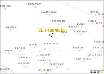
Clifton Mills (West Virginia, United States - USA)Clifton Mills is a town in the West Virginia region of United States - USA. An overview map of the region around Clifton Mills is displayed below.
regional and 3d topo map of Clifton Mills, United States - USA ::
Clifton Mills airports ::
The nearest airport is EKN - Elkins Randolph Co Jennings Randolph, located 92.0 km south of Clifton Mills.
Other airports nearby include PIT - Pittsburgh (pennsylva) Pittsburgh Intl (102.6 km north west), AOO - Altoona Blair Co (129.3 km north east), YNG - Youngstown Warren Rgnl (195.6 km north west), AKR - Akron Fulton Intl (216.4 km north west), Nearby towns ::
Brandonville (3.5km south) //
Salem (3.6km east) //
Bruceton Mills (4.7km south west) //
Gibbon Glade (5.2km north east) //
Hopewell (6.1km south west) //
Little Sandy (7.8km south) //
Elliottsville (8.1km north) //
Five Forks (6.5km north east) //
Five Forks (6.6km north east) //
[all distances 'as the bird flies' and approximate]  Places with similar names to Clifton Mills, United States - USA ::
// Clifton Mills (US)
Disclaimer :: Information on this page comes without warranty of any kind |
||
|
Where is Clifton Mills? Elevation and coordinates ::
Latitude (lat): 39°41'49"N Longitude (lon): 79°37'5"W
Elevation (approx.): 469m (map arrows pan, magnifying glasses zoom) |
||
|
Visiting Clifton Mills? Hotel/Accommodation ::
Book a hotel in Clifton Mills Travel Guide ::
rental cars ::
car rental offers GPS waypoint ::
download a GPX waypoint (PoI) of Clifton Mills for your GPS receiver
|
||