|
search place name
|
||
Long Run (West Virginia, United States - USA)Long Run is a town in the West Virginia region of United States - USA. An overview map of the region around Long Run is displayed below.
regional and 3d topo map of Long Run, United States - USA ::

Long Run airports ::
The nearest airport is EKN - Elkins Randolph Co Jennings Randolph, located 70.9 km south east of Long Run.
Other airports nearby include PIT - Pittsburgh (pennsylva) Pittsburgh Intl (118.2 km north), AOO - Altoona Blair Co (194.7 km north east), AKR - Akron Fulton Intl (204.6 km north west), YNG - Youngstown Warren Rgnl (206.1 km north), Nearby towns ::
Enterprise (1.8km south east) //
Viropa (2.3km south east) //
Hutchinson (2.4km north east) //
Pine Bluff (2.8km south west) //
Shinnston (3.6km south) //
South Worthington (3.2km north east) //
Dixie (3.0km west) //
Sturms Mill (3.5km north west) //
Bethlehem (4.3km south) //
Chiefton (3.8km north east) //
Festus (4.8km north) //
Highland (3.8km east) //
Worthington (4.2km north east) //
Allied (4.7km south east) //
Peora (4.2km west) //
Willard (5.4km south east) //
Prospect Valley (4.9km south west) //
Four States (5.8km north) //
Seminole (5.9km south) //
Bingamon (5.4km north west) //
Helens Run (5.3km north east) //
Killarm (4.8km east) //
Francis (5.0km south east) //
Wyatt (4.9km west) //
Carolina (6.2km north) //
Everson (5.3km north east) //
Haywood (6.2km south west) //
Owings (6.3km south east) //
Adamsville (5.8km south east) //
[all distances 'as the bird flies' and approximate] 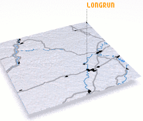 Places with similar names to Long Run, United States - USA ::
// Lǝnkǝran (AZ)
// Langgrün (DE)
// Lankern (DE)
// Long Run (US)
// Lanckorona (PL)
// Langueirón (ES)
// Langueirón (ES)
// Long Run (US)
// Long Green (US)
// Longrun (US)
Disclaimer :: Information on this page comes without warranty of any kind |
||
|
Where is Long Run? Elevation and coordinates ::
Latitude (lat): 39°25'41"N Longitude (lon): 80°17'50"W
Elevation (approx.): 300m (map arrows pan, magnifying glasses zoom) |
||
|
Visiting Long Run? Hotel/Accommodation ::
Book a hotel in Long Run Travel Guide ::
rental cars ::
car rental offers GPS waypoint ::
download a GPX waypoint (PoI) of Long Run for your GPS receiver
|
||