|
search place name
|
||
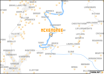
McKendree (West Virginia, United States - USA)McKendree is a town in the West Virginia region of United States - USA. An overview map of the region around McKendree is displayed below.
regional and 3d topo map of McKendree, United States - USA ::
McKendree airports ::
The nearest airport is EKN - Elkins Randolph Co Jennings Randolph, located 153.2 km north east of McKendree.
Other airports nearby include INT - Winston-salem Smith Reynolds (208.6 km south), LCK - Columbus Rickenbacker Intl (268.1 km north west), Nearby towns ::
Prince (3.3km south) //
Claremont (3.5km north) //
Thayer (3.2km north east) //
Royal (3.9km south) //
Quinnimont (4.1km south east) //
Terry Junction (4.6km south) //
Terry (4.3km south west) //
McCreery (5.0km south west) //
Newlyn (6.6km north) //
Meadow Fork (6.2km north west) //
Grandview (7.0km south) //
Wright (7.5km south west) //
Beury (8.2km north) //
Thurmond (8.4km north) //
Laurel Creek (7.0km south east) //
Dewitt (7.4km north west) //
Dimmock (8.5km north) //
Concho (9.1km north) //
Glade (8.3km south east) //
Sanger (8.8km north west) //
Prudence (8.2km north west) //
Harvey (8.3km north west) //
Piney View (8.5km south west) //
[all distances 'as the bird flies' and approximate] 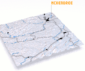 Places with similar names to McKendree, United States - USA ::
Disclaimer :: Information on this page comes without warranty of any kind |
||
|
Where is McKendree? Elevation and coordinates ::
Latitude (lat): 37°53'16"N Longitude (lon): 81°3'49"W
Elevation (approx.): 340m (map arrows pan, magnifying glasses zoom) |
||
|
Visiting McKendree? Hotel/Accommodation ::
Book a hotel in McKendree Travel Guide ::
rental cars ::
car rental offers GPS waypoint ::
download a GPX waypoint (PoI) of McKendree for your GPS receiver
|
||