|
search place name
|
||
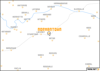
Normantown (West Virginia, United States - USA)Normantown is a town in the West Virginia region of United States - USA. An overview map of the region around Normantown is displayed below.
regional and 3d topo map of Normantown, United States - USA ::
Normantown airports ::
The nearest airport is EKN - Elkins Randolph Co Jennings Randolph, located 93.8 km east of Normantown.
Other airports nearby include PIT - Pittsburgh (pennsylva) Pittsburgh Intl (191.8 km north), LCK - Columbus Rickenbacker Intl (202.2 km north west), CMH - Port Columbus Intl (211.0 km north west), Nearby towns ::
 Places with similar names to Normantown, United States - USA ::
// Normantown (US)
// Normantown (US)
// Normandien (ZA)
// Normandin (CA)
// Normanton (AU)
// Normanton (GB)
// Normanton (GB)
// Normanton (GB)
Disclaimer :: Information on this page comes without warranty of any kind |
||
|
Where is Normantown? Elevation and coordinates ::
Latitude (lat): 38°51'6"N Longitude (lon): 80°56'12"W
Elevation (approx.): 243m (map arrows pan, magnifying glasses zoom) |
||
|
Visiting Normantown? Hotel/Accommodation ::
Book a hotel in Normantown Travel Guide ::
rental cars ::
car rental offers GPS waypoint ::
download a GPX waypoint (PoI) of Normantown for your GPS receiver
|
||