|
search place name
|
||
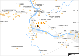
Sattes (West Virginia, United States - USA)Sattes is a town in the West Virginia region of United States - USA. An overview map of the region around Sattes is displayed below.
regional and 3d topo map of Sattes, United States - USA ::
Sattes airports ::
The nearest airport is EKN - Elkins Randolph Co Jennings Randolph, located 179.5 km east of Sattes.
Other airports nearby include LCK - Columbus Rickenbacker Intl (184.8 km north west), CMH - Port Columbus Intl (201.0 km north west), Nearby towns ::
Riverdale Acres (0.9km east) //
Highlawn (1.8km south east) //
Saint Albans (1.7km south west) //
Parkway Terrace (1.8km south east) //
East Nitro (1.8km north west) //
Lone Oak Park (2.4km south west) //
Sun Valley (3.0km south) //
Virginia Heights (2.9km west) //
Nitro (3.4km north west) //
Lincoln Park (3.4km south east) //
Roseville Addition (3.2km west) //
Strawberry Heights (3.3km west) //
Amandaville (3.3km west) //
Marlaina Addition (3.5km north west) //
Cross Lanes (4.0km north east) //
Riverlake (3.9km south west) //
Jefferson (3.8km south east) //
Ferrell (4.5km south) //
Green Valley (4.1km south east) //
Lower Falls (3.8km south west) //
Arborland Acres (3.9km west) //
River Bend (5.2km south west) //
Institute (4.7km east) //
Upper Falls (5.9km south west) //
Valley Brook Mobile Home Park (6.2km north) //
Ortin Heights (6.2km north) //
Rock Branch (6.2km north) //
Tornado (6.0km south west) //
Scary (6.0km north west) //
[all distances 'as the bird flies' and approximate]  Places with similar names to Sattes, United States - USA ::
// Sadies (MA)
// Sidi Aïssa (MA)
// Sidi Aïssa (MA)
// Sidi Aïssa (MA)
// Sidi Aïssa (MA)
// Sidi Aïssa (MA)
// Seytas (AZ)
// Satsa (MM)
// Satse (MM)
// Setzaw (MM)
Disclaimer :: Information on this page comes without warranty of any kind |
||
|
Where is Sattes? Elevation and coordinates ::
Latitude (lat): 38°23'29"N Longitude (lon): 81°49'7"W
Elevation (approx.): 179m (map arrows pan, magnifying glasses zoom) |
||
|
Visiting Sattes? Hotel/Accommodation ::
Book a hotel in Sattes Travel Guide ::
rental cars ::
car rental offers GPS waypoint ::
download a GPX waypoint (PoI) of Sattes for your GPS receiver
|
||