|
search place name
|
||
Smokeless (West Virginia, United States - USA)Smokeless is a town in the West Virginia region of United States - USA. An overview map of the region around Smokeless is displayed below.
regional and 3d topo map of Smokeless, United States - USA ::

Smokeless airports ::
The nearest airport is INT - Winston-salem Smith Reynolds, located 170.9 km south east of Smokeless.
Other airports nearby include HKY - Hickory Rgnl (188.1 km south), EKN - Elkins Randolph Co Jennings Randolph (202.7 km north east), Nearby towns ::
Hiawatha (1.0km north east) //
Matoaka (1.6km south east) //
Giatto (1.7km south) //
Weyanoke (2.1km south west) //
Piedmont (2.3km north west) //
Springton (2.7km north) //
Wenonah (3.7km north) //
Dott (4.0km north) //
Arista (4.5km north) //
Pinoak (4.1km east) //
Lashmeet (4.8km east) //
Lamar (5.3km north west) //
McComas (5.9km south west) //
Mount Olive (5.5km south east) //
Black (6.9km north) //
Godfrey (7.6km south) //
Beeson (6.6km north east) //
Rock (7.6km south) //
Montcalm (8.7km south) //
Kale (7.9km south east) //
Micajah (7.6km north west) //
Garwood (8.3km north west) //
Goodwill (9.3km south) //
Covel (9.0km north west) //
[all distances 'as the bird flies' and approximate] 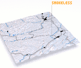 Places with similar names to Smokeless, United States - USA ::
// Samagals (LV)
Disclaimer :: Information on this page comes without warranty of any kind |
||
|
Where is Smokeless? Elevation and coordinates ::
Latitude (lat): 37°25'57"N Longitude (lon): 81°15'5"W
Elevation (approx.): 733m (map arrows pan, magnifying glasses zoom) |
||
|
Visiting Smokeless? Hotel/Accommodation ::
Book a hotel in Smokeless Travel Guide ::
rental cars ::
car rental offers GPS waypoint ::
download a GPX waypoint (PoI) of Smokeless for your GPS receiver
|
||