|
search place name
|
||
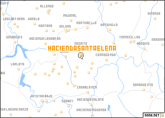
Hacienda Santa Elena (Puerto Rico, United States - USA)Hacienda Santa Elena is a town in the Puerto Rico region of United States - USA. An overview map of the region around Hacienda Santa Elena is displayed below.
regional and 3d topo map of Hacienda Santa Elena, United States - USA ::
Hacienda Santa Elena airports ::
The nearest airport is PSE - Ponce Mercedita, located 33.1 km south of Hacienda Santa Elena.
Other airports nearby include SIG - San Juan Fernando Luis Ribas Dominicci (48.9 km east), SJU - San Juan Luis Munoz Marin Intl (58.0 km east), MAZ - Mayaguez Eugenio Maria De Hostos (65.3 km west), BQN - Aguadilla Rafael Hernandez (66.4 km west), Nearby towns ::
Hacienda Aldea (2.2km south west) //
Hacienda Penonales (2.2km south east) //
Negrito (2.4km north) //
Hacienda Flor de Alba (2.8km south east) //
Hacienda Colom (3.4km south east) //
Hacienda Reynes (3.4km south west) //
Segui (3.7km west) //
Hacienda Garau (4.2km south west) //
Hacienda Marques (4.8km west) //
Cerro Gordo (5.1km east) //
Hacienda Vega Grande (6.1km south west) //
Hacienda Santa Barbara (6.4km south) //
Hacienda Santa Barbara (6.4km south west) //
Hacienda Piedra Gorda (6.2km west) //
Hacienda La Isolina (6.2km west) //
Rafael Arroyo (6.9km north) //
Hacienda Butler (6.7km west) //
Montebello (7.2km north) //
Florida (7.2km north west) //
Hacienda Limon (7.1km south west) //
Selgas (7.3km north west) //
Florida (7.6km north west) //
Casa Blanca (7.6km south) //
Ciales (7.6km north east) //
Hacienda La Catalana (8.1km south west) //
Pajonal (9.1km north) //
Hacienda Las Abras (8.7km north west) //
Hato Viejo (8.9km north east) //
Hacienda Tetuan (8.8km west) //
[all distances 'as the bird flies' and approximate] 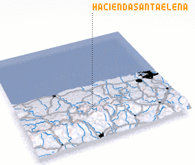 Places with similar names to Hacienda Santa Elena, United States - USA ::
// Hacienda Santa Elena (CR)
// Hacienda Santa Elena (EC)
// Hacienda Santa Elena (EC)
// Hacienda Santa Elena (SV)
// Hacienda Santa Elena (PE)
// Hacienda Santa Elena (HN)
// Hacienda Santa Elena (US)
Disclaimer :: Information on this page comes without warranty of any kind |
||
|
Where is Hacienda Santa Elena? Elevation and coordinates ::
Latitude (lat): 18°18'21"N Longitude (lon): 66°31'58"W
Elevation (approx.): 345m (map arrows pan, magnifying glasses zoom) |
||
|
Visiting Hacienda Santa Elena? Hotel/Accommodation ::
Book a hotel in Hacienda Santa Elena Travel Guide ::
rental cars ::
car rental offers GPS waypoint ::
download a GPX waypoint (PoI) of Hacienda Santa Elena for your GPS receiver
|
||