|
search place name
|
||
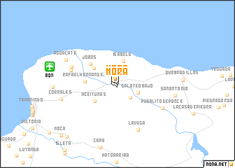
Mora (Puerto Rico, United States - USA)Mora is a town in the Puerto Rico region of United States - USA. An overview map of the region around Mora is displayed below.
regional and 3d topo map of Mora, United States - USA ::
Mora airports ::
The nearest airport is BQN - Aguadilla Rafael Hernandez, located 10.6 km west of Mora.
Other airports nearby include MAZ - Mayaguez Eugenio Maria De Hostos (26.7 km south west), PSE - Ponce Mercedita (71.3 km south east), SIG - San Juan Fernando Luis Ribas Dominicci (98.7 km east), SJU - San Juan Luis Munoz Marin Intl (109.0 km east), Nearby towns ::
Mora (0.6km south) //
Mantilla (3.0km south east) //
Galateo Bajo (3.4km south east) //
Isabela (3.7km north) //
Aceitunas (4.4km south west) //
Santiago (4.4km north west) //
Rafael Hernandez (4.9km west) //
Jobos (5.2km north west) //
Montana (7.4km west) //
San Antonio (7.5km west) //
La Vega (7.9km south east) //
Pueblito de Ponce (7.8km south east) //
Aguacate (8.6km north west) //
Cuba (11.4km south west) //
[all distances 'as the bird flies' and approximate] 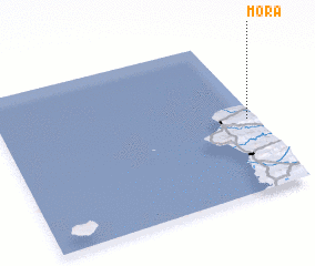 Places with similar names to Mora, United States - USA ::
Disclaimer :: Information on this page comes without warranty of any kind |
||
|
Where is Mora? Elevation and coordinates ::
Latitude (lat): 18°28'12"N Longitude (lon): 67°1'58"W
Elevation (approx.): 125m (map arrows pan, magnifying glasses zoom) |
||
|
Visiting Mora? Hotel/Accommodation ::
Book a hotel in Mora Travel Guide ::
rental cars ::
car rental offers GPS waypoint ::
download a GPX waypoint (PoI) of Mora for your GPS receiver
|
||