|
search place name
|
||
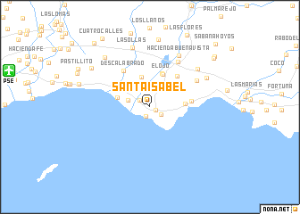
Santa Isabel (Puerto Rico, United States - USA)Santa Isabel is a town in the Puerto Rico region of United States - USA. An overview map of the region around Santa Isabel is displayed below.
regional and 3d topo map of Santa Isabel, United States - USA ::
Santa Isabel airports ::
The nearest airport is PSE - Ponce Mercedita, located 17.3 km west of Santa Isabel.
Other airports nearby include SIG - San Juan Fernando Luis Ribas Dominicci (63.1 km north east), SJU - San Juan Luis Munoz Marin Intl (67.4 km north east), MAZ - Mayaguez Eugenio Maria De Hostos (84.9 km west), FAJ - Fajardo Diego Jimenez Torres (87.2 km north east), Nearby towns ::
Hacienda Florida (0.8km south east) //
Playa de Santa Isabel (1.3km south) //
Velazquez (1.5km north west) //
Hacienda Alomar (1.6km south east) //
Estacion Santa Isabel (2.2km north) //
Chardon (2.8km west) //
Hacienda Altura (3.9km north) //
Playa Cortada (4.0km west) //
Playita Cortada (4.2km north west) //
Jauca (4.2km east) //
Paso Seco (4.4km north) //
El Ojo (4.4km north) //
Cayures (5.1km north east) //
Hacienda Pales (5.0km east) //
Descalabrado (5.5km north west) //
Hacienda Esmeralda (6.6km north east) //
Santiago (6.5km north east) //
Hacienda Buena Vista (7.3km north east) //
Penuelas (7.4km north east) //
Las Ollas (7.7km north) //
Parcelas Penuelas (7.7km north east) //
Hacienda Miranda (8.2km north west) //
Los Puertos (8.5km north) //
Hacienda Amelia (8.5km north west) //
Pastillo (8.9km west) //
Rio Jueyes (9.8km north east) //
Mariano Colon (10.0km north east) //
Cuatro Calles (10.3km north west) //
Rio Canas Abajo (10.4km north west) //
[all distances 'as the bird flies' and approximate]  Places with similar names to Santa Isabel, United States - USA ::
// Santa Isabel (BR)
// Santa Isabel (BR)
// Santa Isabel (BR)
// Santa Isabel (BR)
// Santa Isabel (BR)
// Santa Isabel (BR)
// Santa Isabel (BR)
// Santa Isabel (BR)
// Santa Isabel (BR)
// Santa Isabel (BR)
Disclaimer :: Information on this page comes without warranty of any kind |
||
|
Where is Santa Isabel? Elevation and coordinates ::
Latitude (lat): 17°58'5"N Longitude (lon): 66°24'19"W
Elevation (approx.): 7m (map arrows pan, magnifying glasses zoom) |
||
|
Visiting Santa Isabel? Hotel/Accommodation ::
Book a hotel in Santa Isabel Travel Guide ::
rental cars ::
car rental offers GPS waypoint ::
download a GPX waypoint (PoI) of Santa Isabel for your GPS receiver
|
||