|
search place name
|
||
An Ðoài (Hải Hưng, Vietnam)An Ðoài is a town in the Hải Hưng region of Vietnam. An overview map of the region around An Ðoài is displayed below.
regional and 3d topo map of An Ðoài, Vietnam ::

An Ðoài airports ::
The nearest airport is HAN - Hanoi Noibai Intl, located 61.7 km west of An Ðoài.
Other airports nearby include NNG - Nanning Wuxu (255.5 km north east), Nearby towns ::
Linh Khê (1.7km west) //
Vĩnh Trụ (2.5km north east) //
Tế Sơn (3.5km east) //
Kim Khê (4.1km south east) //
Cổ Pháp (4.1km south east) //
Chi Diên (3.9km south east) //
An Lương (4.1km south west) //
Bạch Ða (4.1km south west) //
Nghĩa Dương (4.1km south west) //
Ðai Thôn (3.9km north east) //
Thụy Trà (3.9km south west) //
Nội Thôn (4.1km north east) //
Tạ Xá (3.9km north west) //
Lũng Ðộng (4.1km north west) //
Ðối Lĩnh (4.1km north west) //
Yèn Ðiên (5.1km south east) //
Lạc Sơn (5.1km north east) //
Mạo Khê (5.1km north east) //
Kim Bịch (5.2km west) //
Ðại Lã (5.2km west) //
Lâu Dộng (5.2km east) //
Dục Tr (5.5km west) //
Ngọc Trì (5.8km south) //
Nhân Lễ (5.8km south) //
Lâu Khê (5.5km west) //
Kiệt Ðăc (5.8km north) //
Hậu Quan (5.8km north) //
Ninh Trấp (6.5km north east) //
Nhân Lý (6.5km south west) //
[all distances 'as the bird flies' and approximate] 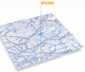 Places with similar names to An Ðoài, Vietnam ::
Disclaimer :: Information on this page comes without warranty of any kind |
||
|
Where is An Ðoài? Elevation and coordinates ::
Latitude (lat): 21°2'0"N Longitude (lon): 106°22'0"E
Elevation (approx.): 7m (map arrows pan, magnifying glasses zoom) |
||
|
Visiting An Ðoài? Hotel/Accommodation ::
Book a hotel in An Ðoài Travel Guide ::
Buy a travel guide for Vietnam rental cars ::
car rental offers GPS waypoint ::
download a GPX waypoint (PoI) of An Ðoài for your GPS receiver
|
||