|
search place name
|
||
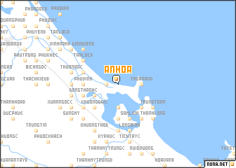
An Hòa (Quảng Nam-Ðà Nẵng, Vietnam)An Hòa is a town in the Quảng Nam-Ðà Nẵng region of Vietnam. An overview map of the region around An Hòa is displayed below.
regional and 3d topo map of An Hòa, Vietnam ::
An Hòa airports ::
The nearest airport is DAD - Danang Intl, located 77.2 km north west of An Hòa.
Nearby towns ::
Tân An (2) (1.8km west) //
Thuận An (3) (3.6km east) //
Ðông Xuân (3.7km south) //
Bình An (1) (4.0km south west) //
Ðông Tuần (5.1km south east) //
Khương Dại (2) (5.1km south west) //
Ðông Bình (5.6km south) //
Lý Tín (5.6km south) //
Phú Vinh (5.4km west) //
Sâm Linh (5.8km south) //
Ðông Thạnh (2) (5.7km west) //
Hòa Xuân (1) (5.7km west) //
Hòa Trà (3) (5.7km west) //
Trung Toàn (6.5km south east) //
An Tây (1) (6.6km south east) //
Tiên Xuân (4) (6.5km south west) //
Tam Lôc (1) (6.5km north west) //
Lý Trà (7.1km west) //
An Tân (7.4km south) //
Long Bình (7.6km south) //
Ðiêm Phổ (2) (7.4km west) //
Thuận An (2) (7.4km west) //
Thanh Long (7.7km south east) //
Phu Xuan Ha (7.7km south east) //
Khương Nhơn (2) (7.7km south west) //
Ðiêm Ðiên (3) (7.7km north west) //
Kỳ Khương (8.0km south west) //
Khương Thọ (1) (8.2km south west) //
Tam Lôc (2) (9.1km north west) //
[all distances 'as the bird flies' and approximate] 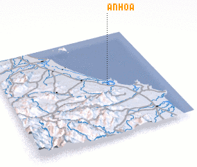 Places with similar names to An Hòa, Vietnam ::
Disclaimer :: Information on this page comes without warranty of any kind |
||
|
Where is An Hòa? Elevation and coordinates ::
Latitude (lat): 15°30'0"N Longitude (lon): 108°39'0"E
Elevation (approx.): -32768m (map arrows pan, magnifying glasses zoom) |
||
|
Visiting An Hòa? Hotel/Accommodation ::
Book a hotel in An Hòa Travel Guide ::
Buy a travel guide for Vietnam rental cars ::
car rental offers GPS waypoint ::
download a GPX waypoint (PoI) of An Hòa for your GPS receiver
|
||