|
search place name
|
||
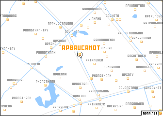
Ấp Bầu Cá Một (Bạc Liêu, Vietnam)Ấp Bầu Cá Một is a town in the Bạc Liêu region of Vietnam. An overview map of the region around Ấp Bầu Cá Một is displayed below.
regional and 3d topo map of Ấp Bầu Cá Một, Vietnam ::
Ấp Bầu Cá Một airports ::
The nearest airport is SGN - Ho Chi Minh City Tansonnhat Intl, located 213.8 km north east of Ấp Bầu Cá Một.
Nearby towns ::
Ấp Ranh Hạt (3.2km north west) //
Ấp Tăng Hem (3.3km south east) //
Ấp Ðồng Miễu I (5.2km south east) //
Ấp Kim Xĩa (1) (5.5km east) //
Ấp Vĩnh An (5.6km north west) //
Ấp Kim Xĩa (2) (5.8km east) //
Ấp Số Một (5.8km north west) //
Ấp Vình Huệ Mội (6.1km north east) //
Phong Thạnh (6.7km south east) //
Ấp Bến Mã (6.8km south west) //
Ấp Nọc Nạn (I) (6.9km south) //
Xóm Kinh Nhỏ (7.2km north) //
Ấp Số Hai (7.2km west) //
Ấp Phước Thọ (7.5km north) //
Xóm Ba Ðình (7.5km south east) //
Phong Thạnh (8.1km west) //
Ấp Phước Trướng (8.5km north west) //
Vĩnh Phú (8.7km north) //
Ấp Kinh Ngang (9.4km south east) //
Ấp Ut Thượng (9.4km south east) //
Xóm Xã Tá (9.8km north east) //
Ấp Số Tám (9.8km north west) //
Phong Thạnh (10.3km south west) //
Cầu Xã Tá (11.3km north east) //
Ấp Vĩnh Phước Ba (12.0km north east) //
[all distances 'as the bird flies' and approximate] 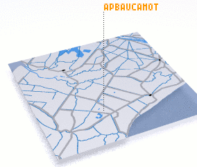 Places with similar names to Ấp Bầu Cá Một, Vietnam :: Disclaimer :: Information on this page comes without warranty of any kind |
||
|
Where is Ấp Bầu Cá Một? Elevation and coordinates ::
Latitude (lat): 9°19'13"N Longitude (lon): 105°25'11"E
Elevation (approx.): 2m (map arrows pan, magnifying glasses zoom) |
||
|
Visiting Ấp Bầu Cá Một? Hotel/Accommodation ::
Book a hotel in Ấp Bầu Cá Một Travel Guide ::
Buy a travel guide for Vietnam rental cars ::
car rental offers GPS waypoint ::
download a GPX waypoint (PoI) of Ấp Bầu Cá Một for your GPS receiver
|
||