|
search place name
|
||
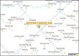
Ấp Ninh Thạnh Chài (Bạc Liêu, Vietnam)Ấp Ninh Thạnh Chài is a town in the Bạc Liêu region of Vietnam. An overview map of the region around Ấp Ninh Thạnh Chài is displayed below.
regional and 3d topo map of Ấp Ninh Thạnh Chài, Vietnam ::
Ấp Ninh Thạnh Chài airports ::
The nearest airport is SGN - Ho Chi Minh City Tansonnhat Intl, located 192.6 km north east of Ấp Ninh Thạnh Chài.
Nearby towns ::
Ấp Ninh Lợi (1.1km east) //
Xóm Cầu Sắt (2.6km east) //
Ấp Ninh Thạnh Chùa (3.1km south east) //
Ninh Hòa (1) (4.3km north west) //
Ấp Vĩnh Mỹ Một (5.1km south west) //
Ninh Hòa (2) (5.6km west) //
Ấp Vĩnh Mỹ (1) (5.8km south east) //
Ấp Vĩnh Mỹ (2) (5.9km east) //
Ấp Ninh Lợi (6.3km north west) //
Ninh Hòa (6.4km west) //
Xóm Hào Cáo (7.6km south east) //
Phước Long (8.1km south west) //
Ấp Vĩnh Mỹ Hai (8.6km south) //
Xóm Rộc Lá (8.7km south east) //
Ấp Mỹ Thọ (8.9km south east) //
Ấp Bào Sấu (9.1km north east) //
Ấp Mỹ Ðông (10.7km south east) //
Ấp Cái Trầu (11.3km north east) //
[all distances 'as the bird flies' and approximate] 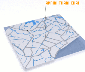 Places with similar names to Ấp Ninh Thạnh Chài, Vietnam ::
// Ấp Ninh Thạnh Chùa (VN)
Disclaimer :: Information on this page comes without warranty of any kind |
||
|
Where is Ấp Ninh Thạnh Chài? Elevation and coordinates ::
Latitude (lat): 9°29'44"N Longitude (lon): 105°30'35"E
(map arrows pan, magnifying glasses zoom) |
||
|
Visiting Ấp Ninh Thạnh Chài? Hotel/Accommodation ::
Book a hotel in Ấp Ninh Thạnh Chài Travel Guide ::
Buy a travel guide for Vietnam rental cars ::
car rental offers GPS waypoint ::
download a GPX waypoint (PoI) of Ấp Ninh Thạnh Chài for your GPS receiver
|
||