|
search place name
|
||
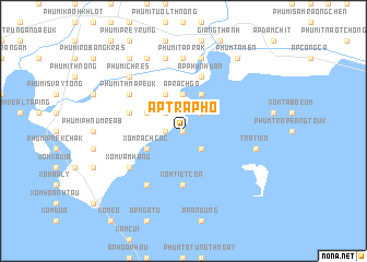
Ấp Trà Phô (Kiến Giang, Vietnam)Ấp Trà Phô is a town in the Kiến Giang region of Vietnam. An overview map of the region around Ấp Trà Phô is displayed below.
regional and 3d topo map of Ấp Trà Phô, Vietnam ::
Ấp Trà Phô airports ::
The nearest airport is PNH - Phnom-penh Phnom Penh Intl, located 125.0 km north of Ấp Trà Phô.
Nearby towns ::
Xóm Tiến Mỹ (0.0km north) //
Phú Mỹ (1.8km west) //
Ấp Cà Pho (2.6km south east) //
Ấp Cỏ Săng (2.6km north east) //
Phumĭ Ânlóng Krănh (2.6km north west) //
Ấp Rạch Gỗ (3.7km north) //
Ấp Giồng Kè (4.1km north east) //
Phumĭ Kaôh Tnaôt (4.1km north west) //
Ấp Mương Khai (4.1km south west) //
Phumĭ Ânlóng Pring (4.1km north west) //
Xóm Rạch Các (4.1km south west) //
Xóm Tiệt Côn (5.6km south) //
Phumĭ Kaôh Ta Kov (5.9km north) //
Ấp Phú Nhuận (5.9km north) //
Phumĭ Kaôh Châmkar (5.8km west) //
Xóm Vàm Hàng (6.6km south west) //
Phumĭ Thmâ Peuk (6.6km north west) //
Xóm Láng Tranh (6.6km south west) //
Phumĭ Ta Prăk (7.4km north) //
Trà Tiên (7.5km east) //
Phumĭ Prey Prus (7.6km north) //
Phumĭ Chrey (7.6km north) //
Phumĭ Chrés (7.8km north west) //
Phumĭ Kaôh Măk Prang (8.3km north west) //
Phum Tà Mên (9.2km north east) //
Phumĭ Chrés (9.2km north west) //
[all distances 'as the bird flies' and approximate] 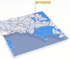 Places with similar names to Ấp Trà Phô, Vietnam ::
// Ấp Tra Võ (VN)
Disclaimer :: Information on this page comes without warranty of any kind |
||
|
Where is Ấp Trà Phô? Elevation and coordinates ::
Latitude (lat): 10°27'0"N Longitude (lon): 104°34'0"E
Elevation (approx.): 3m (map arrows pan, magnifying glasses zoom) |
||
|
Visiting Ấp Trà Phô? Hotel/Accommodation ::
Book a hotel in Ấp Trà Phô Travel Guide ::
Buy a travel guide for Vietnam rental cars ::
car rental offers GPS waypoint ::
download a GPX waypoint (PoI) of Ấp Trà Phô for your GPS receiver
|
||